Western Australia Land Use 1968
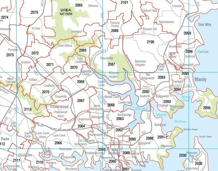
Western Australia — Land Use (1968 Edition)
1000 × 715 mm • Paper / Laminated / Laminated + Hang Rails / Canvas / Canvas + Hang Rails • Made in Australia
A beautifully reproduced 1968 land-use map of Western Australia showing the state’s predominant uses at the time—cattle grazing, sheep districts, cereal cropping belts, mixed-farming areas, and more. A striking historical snapshot for agribusiness offices, classrooms, libraries, homesteads, and collectors.
🗺️ What’s Shown
-
Primary land uses (1968): cattle, sheep, cereal, and mixed-farming zones
-
Clear legend & colour coding for instant at-a-glance interpretation
-
Wall-readable design with balanced typography and clean symbology
A conversation piece and a reliable historical reference—great for comparing past and present land use.
🎨 Finishes & Display Options
-
📄 Paper (FSC® 160 gsm Matte-Coated)
Smooth, low-glare stock—ideal for framing under glass. Printed with archival Hewlett-Packard pigment inks for excellent fade resistance. -
💧 Laminated (True Encapsulation)
Printed on 120 gsm and sealed in 2 × 80-micron gloss laminate (edge-sealed).
Wipe-clean • Tear-resistant • Marker-friendly (use non-permanent whiteboard markers). Perfect for high-use spaces. -
🪵 Laminated + Timber Hang Rails (Ready to Hang)
Natural lacquered timber rails top & bottom + top hanging cord for a clean, frame-free presentation.
⏱️ Custom finish — please allow up to 10 working days for rail fitting. -
🖼️ Canvas (HP 395 gsm Professional Matte)
Gallery-grade canvas printed with archival HP pigment inks for rich detail and fade resistance. Low-glare, tactile surface suits executive and heritage settings. -
🪵 Canvas + Timber Hang Rails
The same premium canvas, finished with natural timber rails + top hanging cord—a ready-to-hang statement piece.
⏱️ Custom finish — please allow up to 10 working days for rail fitting.
Dry-erase markers are recommended only on laminated versions.
📐 Specifications
| Attribute | Details |
|---|---|
| Title | Western Australia — Land Use (1968 Edition) |
| Content | Historical land-use zones: cattle, sheep, cereal, mixed farming & more |
| Year | 1968 reproduction |
| Size | 1000 mm (W) × 715 mm (H) |
| Formats | Paper • Laminated • Laminated + Hang Rails • Canvas • Canvas + Hang Rails |
| Paper | FSC® 160 gsm matte-coated |
| Canvas | HP 395 gsm Professional Matte |
| Inks | Archival Hewlett-Packard pigment (fade-resistant) |
| Origin | Made in Australia |
🤝 Our Commitment
-
Local craftsmanship: Designed, printed, and finished in Australia for consistent quality and responsive support.
-
Clarity first: Legends, colours, and label hierarchies tuned for wall readability.
-
Archival materials: FSC® papers, heavy-duty canvas, and HP pigment inks for long-term colour stability.
-
Packed with care: Every map is hand-checked and securely boxed to arrive clean and display-ready.
Add a timeless Western Australian land-use reference to your wall. Choose Paper, Laminated, Laminated + Hang Rails, Canvas, or Canvas + Hang Rails and enjoy a piece of agricultural history—beautifully presented.
Product Information
Product Information
Shipping & Returns
Shipping & Returns

Western Australia Land Use 1968
Western Australia Land Use 1968
Western Australia — Land Use (1968 Edition)
1000 × 715 mm • Paper / Laminated / Laminated + Hang Rails / Canvas / Canvas + Hang Rails • Made in Australia
A beautifully reproduced 1968 land-use map of Western Australia showing the state’s predominant uses at the time—cattle grazing, sheep districts, cereal cropping belts, mixed-farming areas, and more. A striking historical snapshot for agribusiness offices, classrooms, libraries, homesteads, and collectors.
🗺️ What’s Shown
-
Primary land uses (1968): cattle, sheep, cereal, and mixed-farming zones
-
Clear legend & colour coding for instant at-a-glance interpretation
-
Wall-readable design with balanced typography and clean symbology
A conversation piece and a reliable historical reference—great for comparing past and present land use.
🎨 Finishes & Display Options
-
📄 Paper (FSC® 160 gsm Matte-Coated)
Smooth, low-glare stock—ideal for framing under glass. Printed with archival Hewlett-Packard pigment inks for excellent fade resistance. -
💧 Laminated (True Encapsulation)
Printed on 120 gsm and sealed in 2 × 80-micron gloss laminate (edge-sealed).
Wipe-clean • Tear-resistant • Marker-friendly (use non-permanent whiteboard markers). Perfect for high-use spaces. -
🪵 Laminated + Timber Hang Rails (Ready to Hang)
Natural lacquered timber rails top & bottom + top hanging cord for a clean, frame-free presentation.
⏱️ Custom finish — please allow up to 10 working days for rail fitting. -
🖼️ Canvas (HP 395 gsm Professional Matte)
Gallery-grade canvas printed with archival HP pigment inks for rich detail and fade resistance. Low-glare, tactile surface suits executive and heritage settings. -
🪵 Canvas + Timber Hang Rails
The same premium canvas, finished with natural timber rails + top hanging cord—a ready-to-hang statement piece.
⏱️ Custom finish — please allow up to 10 working days for rail fitting.
Dry-erase markers are recommended only on laminated versions.
📐 Specifications
| Attribute | Details |
|---|---|
| Title | Western Australia — Land Use (1968 Edition) |
| Content | Historical land-use zones: cattle, sheep, cereal, mixed farming & more |
| Year | 1968 reproduction |
| Size | 1000 mm (W) × 715 mm (H) |
| Formats | Paper • Laminated • Laminated + Hang Rails • Canvas • Canvas + Hang Rails |
| Paper | FSC® 160 gsm matte-coated |
| Canvas | HP 395 gsm Professional Matte |
| Inks | Archival Hewlett-Packard pigment (fade-resistant) |
| Origin | Made in Australia |
🤝 Our Commitment
-
Local craftsmanship: Designed, printed, and finished in Australia for consistent quality and responsive support.
-
Clarity first: Legends, colours, and label hierarchies tuned for wall readability.
-
Archival materials: FSC® papers, heavy-duty canvas, and HP pigment inks for long-term colour stability.
-
Packed with care: Every map is hand-checked and securely boxed to arrive clean and display-ready.
Add a timeless Western Australian land-use reference to your wall. Choose Paper, Laminated, Laminated + Hang Rails, Canvas, or Canvas + Hang Rails and enjoy a piece of agricultural history—beautifully presented.
Original: $69.95
-70%$69.95
$20.98Product Information
Product Information
Shipping & Returns
Shipping & Returns
Description
Western Australia — Land Use (1968 Edition)
1000 × 715 mm • Paper / Laminated / Laminated + Hang Rails / Canvas / Canvas + Hang Rails • Made in Australia
A beautifully reproduced 1968 land-use map of Western Australia showing the state’s predominant uses at the time—cattle grazing, sheep districts, cereal cropping belts, mixed-farming areas, and more. A striking historical snapshot for agribusiness offices, classrooms, libraries, homesteads, and collectors.
🗺️ What’s Shown
-
Primary land uses (1968): cattle, sheep, cereal, and mixed-farming zones
-
Clear legend & colour coding for instant at-a-glance interpretation
-
Wall-readable design with balanced typography and clean symbology
A conversation piece and a reliable historical reference—great for comparing past and present land use.
🎨 Finishes & Display Options
-
📄 Paper (FSC® 160 gsm Matte-Coated)
Smooth, low-glare stock—ideal for framing under glass. Printed with archival Hewlett-Packard pigment inks for excellent fade resistance. -
💧 Laminated (True Encapsulation)
Printed on 120 gsm and sealed in 2 × 80-micron gloss laminate (edge-sealed).
Wipe-clean • Tear-resistant • Marker-friendly (use non-permanent whiteboard markers). Perfect for high-use spaces. -
🪵 Laminated + Timber Hang Rails (Ready to Hang)
Natural lacquered timber rails top & bottom + top hanging cord for a clean, frame-free presentation.
⏱️ Custom finish — please allow up to 10 working days for rail fitting. -
🖼️ Canvas (HP 395 gsm Professional Matte)
Gallery-grade canvas printed with archival HP pigment inks for rich detail and fade resistance. Low-glare, tactile surface suits executive and heritage settings. -
🪵 Canvas + Timber Hang Rails
The same premium canvas, finished with natural timber rails + top hanging cord—a ready-to-hang statement piece.
⏱️ Custom finish — please allow up to 10 working days for rail fitting.
Dry-erase markers are recommended only on laminated versions.
📐 Specifications
| Attribute | Details |
|---|---|
| Title | Western Australia — Land Use (1968 Edition) |
| Content | Historical land-use zones: cattle, sheep, cereal, mixed farming & more |
| Year | 1968 reproduction |
| Size | 1000 mm (W) × 715 mm (H) |
| Formats | Paper • Laminated • Laminated + Hang Rails • Canvas • Canvas + Hang Rails |
| Paper | FSC® 160 gsm matte-coated |
| Canvas | HP 395 gsm Professional Matte |
| Inks | Archival Hewlett-Packard pigment (fade-resistant) |
| Origin | Made in Australia |
🤝 Our Commitment
-
Local craftsmanship: Designed, printed, and finished in Australia for consistent quality and responsive support.
-
Clarity first: Legends, colours, and label hierarchies tuned for wall readability.
-
Archival materials: FSC® papers, heavy-duty canvas, and HP pigment inks for long-term colour stability.
-
Packed with care: Every map is hand-checked and securely boxed to arrive clean and display-ready.
Add a timeless Western Australian land-use reference to your wall. Choose Paper, Laminated, Laminated + Hang Rails, Canvas, or Canvas + Hang Rails and enjoy a piece of agricultural history—beautifully presented.