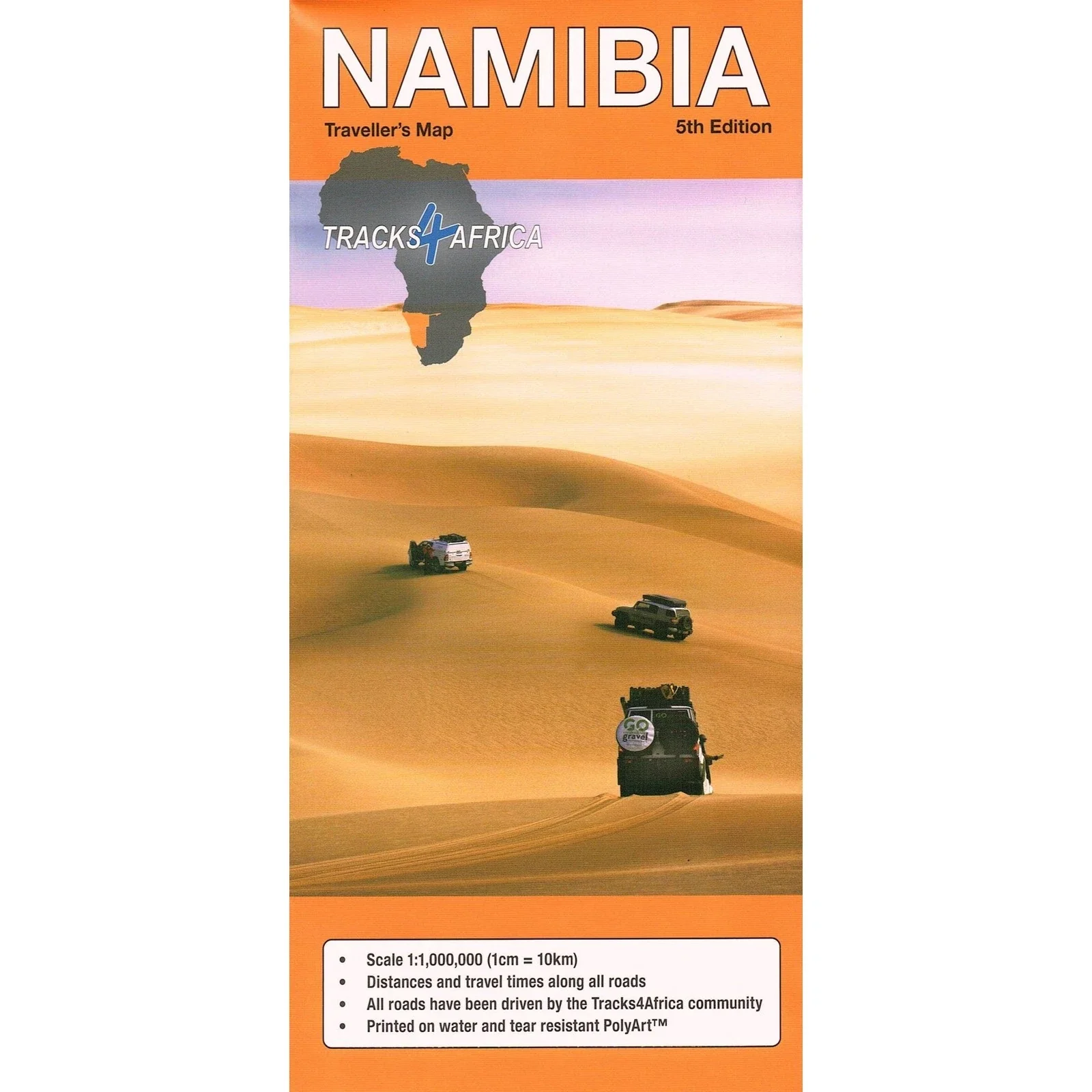
Namibia — Tracks4Africa Overlander Map
Scale 1 : 1,000,000 | GPS-Verified Routes | Waterproof PolyArt
🏜️ Sossusvlei • Etosha • Skeleton Coast • Kaokoland • Fish River Canyon
Vast, raw and magnificently open — Namibia is one of Africa’s great self-drive destinations. The Tracks4Africa Namibia Map is purpose-built for overlanders and independent travellers who need more than a tourist road map. Built from verified GPS track data and real-world overland experience, this map delivers the practical detail required to navigate Namibia’s long distances, gravel highways and remote 4×4 routes with confidence.
At 1:1,000,000 scale (1 cm ≈ 10 km), it provides country-wide coverage while retaining excellent clarity — making it one of the most useful planning maps available for Namibia.
🌍 What Makes This Map Different
Unlike generic road maps, this edition integrates:
🛰️ GPS-aligned cartography — what you see on paper matches Tracks4Africa GPS data
📏 Travel times & distances printed along routes — plan realistic daily stages
🛣️ Full road & track network — sealed highways, gravel roads and remote 4×4 tracks
🏕️ Campsites & attractions marked clearly — practical touring information
🗺️ National Park detail — internal tracks shown inside protected areas
🏙️ City plans of major centres — including detailed insets
📍 Comprehensive place name register — fast lookup while navigating
🛂 Border crossings indicated — including operating times
It’s the combination of geographic overview and GPS precision that makes this map so valuable in Namibia’s remote landscapes.
🐘 Coverage Highlights
This map is ideal for planning journeys through:
-
The dunes of Sossusvlei
-
Wildlife corridors in Etosha National Park
-
The rugged coastline of the Skeleton Coast
-
Remote northern routes through Kaokoland
-
The dramatic landscapes of Fish River Canyon
-
Cross-border connections into Botswana, Zambia, Zimbabwe and South Africa
Namibia’s beauty lies in its scale — and this map lets you see how those iconic destinations connect.
🚙 Designed for Real Overland Conditions
Namibia’s road network is diverse — from smooth tar highways to corrugated gravel and deep sand tracks. Knowing accurate travel times and distances is essential for:
✔️ Planning fuel stops between remote settlements
✔️ Estimating daylight driving windows
✔️ Comparing alternate routes
✔️ Understanding distances inside national parks
✔️ Managing cross-border transitions
Digital navigation is helpful — but this paper map provides the big-picture situational awareness that screens often fragment.
💪 Expedition-Ready PolyArt Printing
Printed on tear- and water-resistant PolyArt, this map is made for harsh conditions:
💧 Water resistant
🌞 Sun and heat tolerant
🏕️ Durable on camp tables
🚙 Dashboard friendly
📦 Folds easily to show only the area you need
This is not delicate paper — it’s designed for real-world expedition use.
📐 Specifications
📏 Scale: 1 : 1,000,000
📄 Format: Folded national sheet
💧 Material: Waterproof & tear-resistant PolyArt
🗺️ Coverage: Entire Namibia with major parks and cities
🚗 Features: Travel times, distances, full road & 4×4 network
🎯 Who This Map Is For
🚙 4×4 overlanders
🏕️ Self-drive safari travellers
📍 Independent road trippers
🌍 Expedition planners crossing multiple countries
🧭 Travellers who value paper reliability in remote areas
If you’re exploring Namibia by vehicle — whether for a two-week safari or a multi-month overland journey — this map gives you clarity, realism and confidence.
📦 Ordering Information
This is an Order-on-Demand map.
🕒 Please allow up to 10 working days for delivery.
⭐ Why Paper Still Matters in Namibia
Distances are long. Reception can disappear. Batteries drain.
A full-country paper map gives you:
✔️ Instant overview of the entire route
✔️ Reliable navigation without signal
✔️ Shared planning around a campfire
✔️ Confidence when travelling off-grid
The Tracks4Africa Namibia Overlander Map is widely regarded as one of the most practical country maps available for Namibia — because it reflects real travel, real tracks and real conditions.
Unfold it. Trace your route across desert and savannah. And set out into Namibia with confidence.