New South Wales Health & Hospitals Map 1190 x 870mm Wall Map
Detailed Planning Map | 1190 x 870 mm | Laminated Finish Available
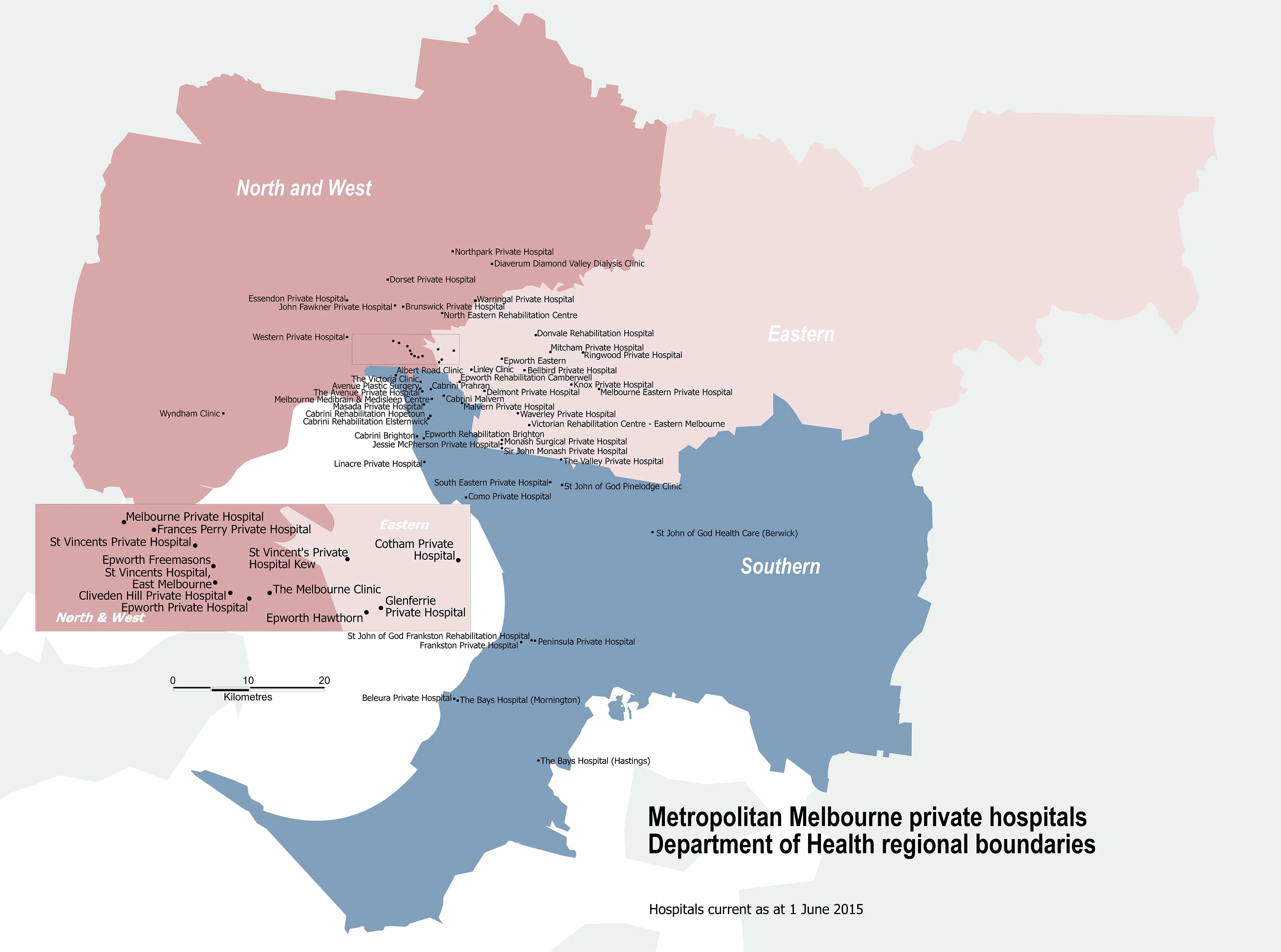
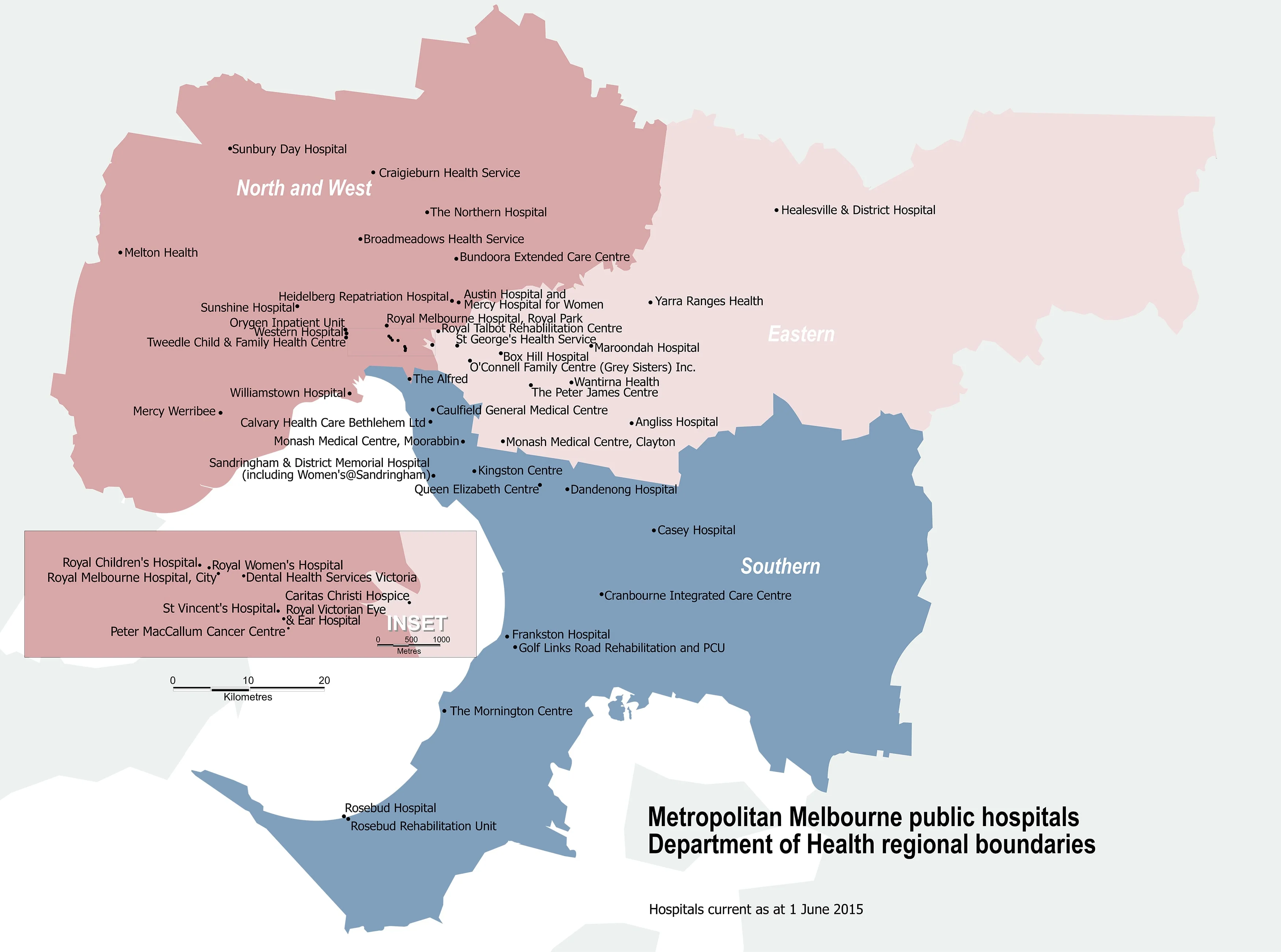
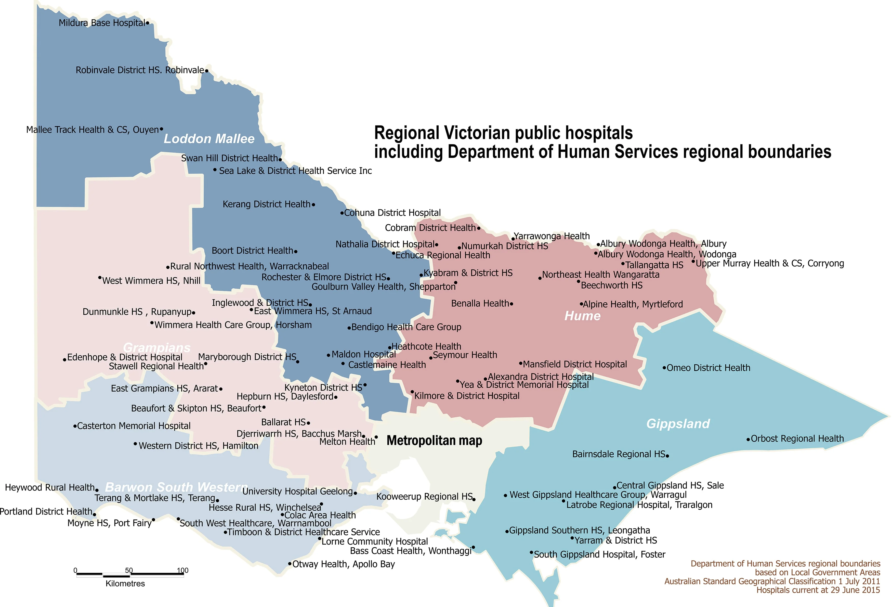
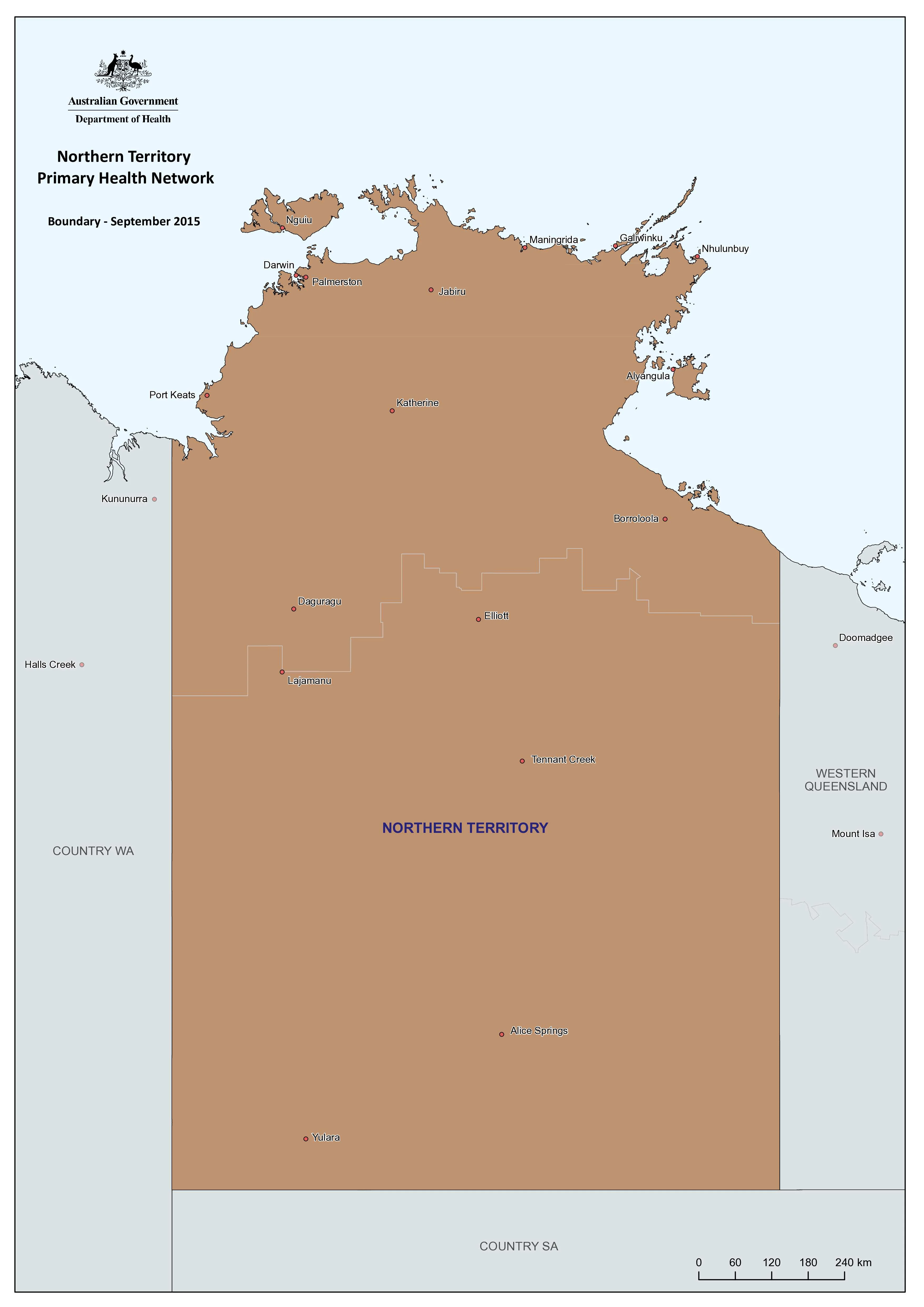
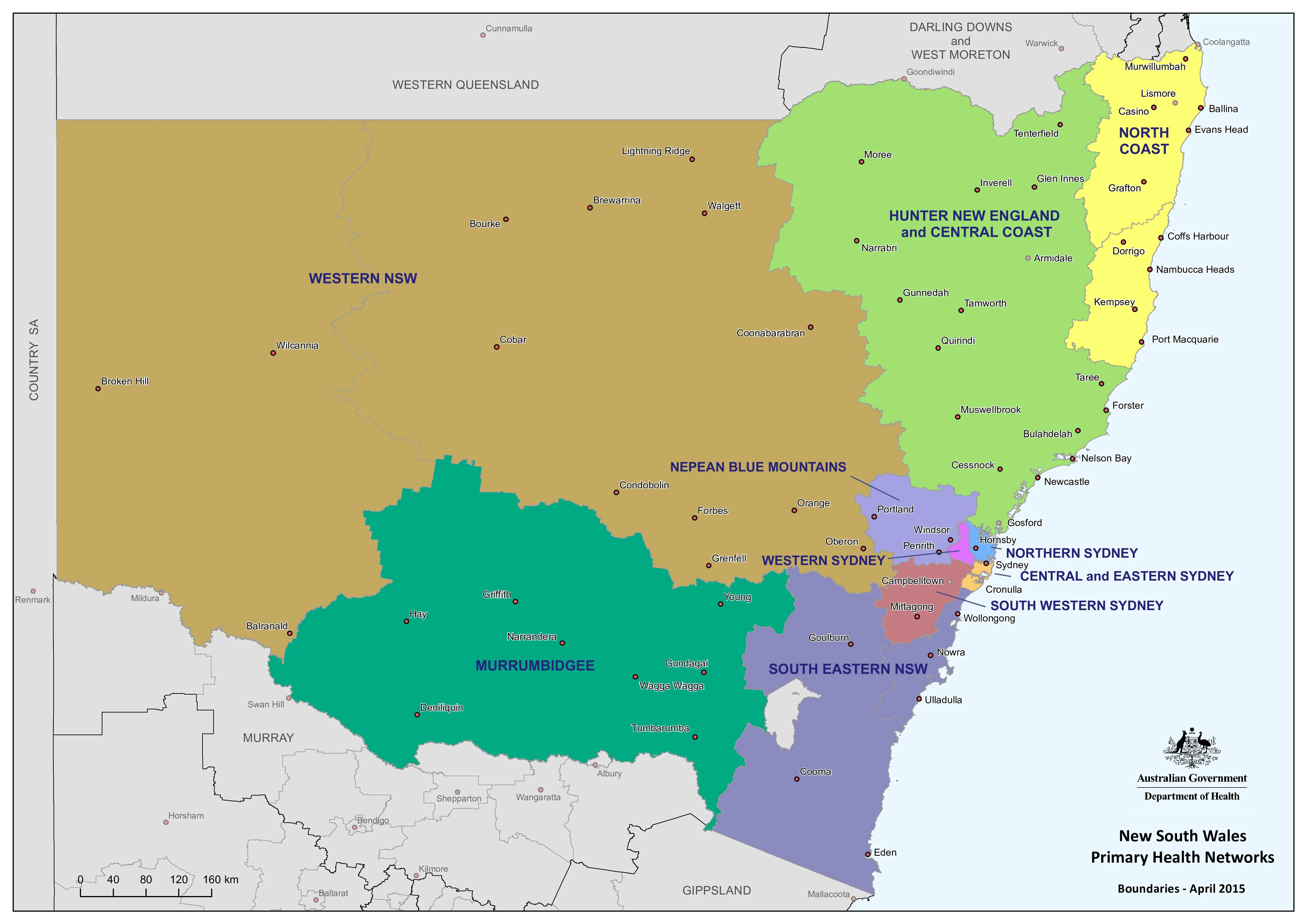
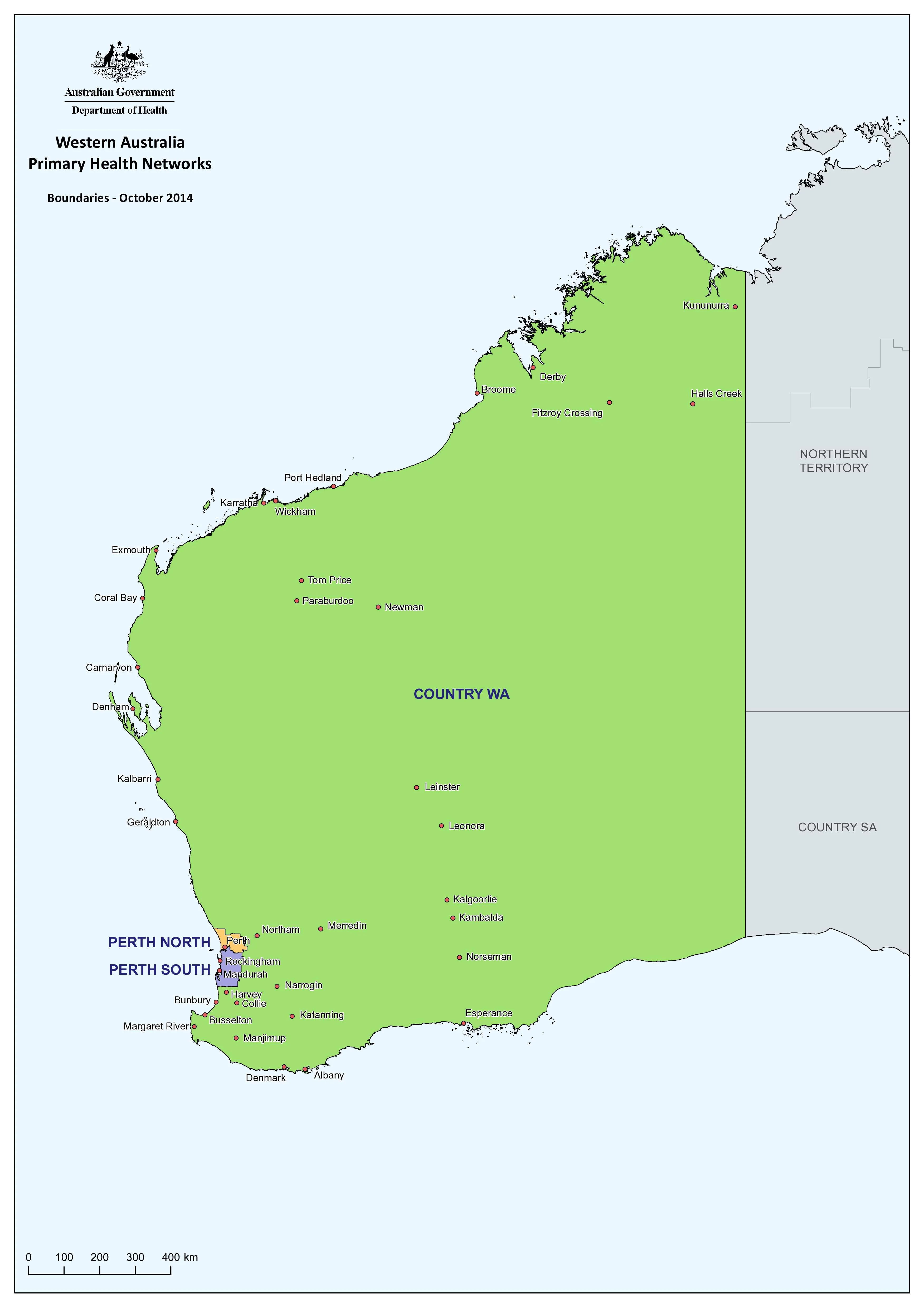
An essential reference for health professionals, administrators, government agencies, and emergency planners, the New South Wales Health & Hospitals Map provides a clear and comprehensive overview of the state’s public health infrastructure.
This large-format wall map presents critical administrative and geographical data, making it ideal for strategic planning, resource allocation, and operational logistics across NSW’s health network.
🔍 Key Features
| Category | Details |
|---|---|
| Map Focus | Health Districts, Public Hospitals, LGAs, Roads |
| Coverage | Entire state of New South Wales |
| Map Format | Wall Map (Flat) |
| Finish Options | Laminated or Paper |
| Size | 1190 mm (w) × 870 mm (h) |
🏨 What This Map Shows
-
NSW Local Health District Boundaries: Clearly delineated to help visualise catchment areas and jurisdictions.
-
Public Hospital Locations: Every NSW public hospital is accurately marked, enabling rapid identification of facilities.
-
Local Government Areas (LGAs): LGA boundaries provide important administrative context for healthcare governance.
-
Major Roads & Highways: An essential inclusion for logistics, travel-time assessments, and emergency access routes.
🖊️ Laminated for Utility
This map is available in a high-quality gloss laminate, allowing for practical use in dynamic settings:
-
Write and wipe with whiteboard markers
-
Apply map dots or pins for planning, training, or coordination
-
Easy to clean and resistant to tears, creases, and spills
Whether you're in a hospital boardroom, local health office, ambulance command centre, or state department, this map is built for daily use.
🧭 Ideal For:
-
Health Planners & Administrators
-
Emergency Services & Crisis Management Teams
-
Hospital Management & Regional Health Boards
-
Public Health Policy and Research
-
Educational Institutions in Health & Urban Planning
✅ Practical and Professional
Designed to meet the needs of busy professionals, this map combines clarity with accuracy. It’s perfect for wall mounting in offices, operations centres, or classrooms where having a clear view of NSW’s health geography is critical.
Plan smarter. Act faster. See the whole picture.
This is the definitive NSW health and hospital reference map.
Product Information
Product Information
Shipping & Returns
Shipping & Returns

New South Wales Health & Hospitals Map 1190 x 870mm Wall Map
New South Wales Health & Hospitals Map 1190 x 870mm Wall Map
Detailed Planning Map | 1190 x 870 mm | Laminated Finish Available
An essential reference for health professionals, administrators, government agencies, and emergency planners, the New South Wales Health & Hospitals Map provides a clear and comprehensive overview of the state’s public health infrastructure.
This large-format wall map presents critical administrative and geographical data, making it ideal for strategic planning, resource allocation, and operational logistics across NSW’s health network.
🔍 Key Features
| Category | Details |
|---|---|
| Map Focus | Health Districts, Public Hospitals, LGAs, Roads |
| Coverage | Entire state of New South Wales |
| Map Format | Wall Map (Flat) |
| Finish Options | Laminated or Paper |
| Size | 1190 mm (w) × 870 mm (h) |
🏨 What This Map Shows
-
NSW Local Health District Boundaries: Clearly delineated to help visualise catchment areas and jurisdictions.
-
Public Hospital Locations: Every NSW public hospital is accurately marked, enabling rapid identification of facilities.
-
Local Government Areas (LGAs): LGA boundaries provide important administrative context for healthcare governance.
-
Major Roads & Highways: An essential inclusion for logistics, travel-time assessments, and emergency access routes.
🖊️ Laminated for Utility
This map is available in a high-quality gloss laminate, allowing for practical use in dynamic settings:
-
Write and wipe with whiteboard markers
-
Apply map dots or pins for planning, training, or coordination
-
Easy to clean and resistant to tears, creases, and spills
Whether you're in a hospital boardroom, local health office, ambulance command centre, or state department, this map is built for daily use.
🧭 Ideal For:
-
Health Planners & Administrators
-
Emergency Services & Crisis Management Teams
-
Hospital Management & Regional Health Boards
-
Public Health Policy and Research
-
Educational Institutions in Health & Urban Planning
✅ Practical and Professional
Designed to meet the needs of busy professionals, this map combines clarity with accuracy. It’s perfect for wall mounting in offices, operations centres, or classrooms where having a clear view of NSW’s health geography is critical.
Plan smarter. Act faster. See the whole picture.
This is the definitive NSW health and hospital reference map.
Original: $69.95
-70%$69.95
$20.98Product Information
Product Information
Shipping & Returns
Shipping & Returns
Description
Detailed Planning Map | 1190 x 870 mm | Laminated Finish Available
An essential reference for health professionals, administrators, government agencies, and emergency planners, the New South Wales Health & Hospitals Map provides a clear and comprehensive overview of the state’s public health infrastructure.
This large-format wall map presents critical administrative and geographical data, making it ideal for strategic planning, resource allocation, and operational logistics across NSW’s health network.
🔍 Key Features
| Category | Details |
|---|---|
| Map Focus | Health Districts, Public Hospitals, LGAs, Roads |
| Coverage | Entire state of New South Wales |
| Map Format | Wall Map (Flat) |
| Finish Options | Laminated or Paper |
| Size | 1190 mm (w) × 870 mm (h) |
🏨 What This Map Shows
-
NSW Local Health District Boundaries: Clearly delineated to help visualise catchment areas and jurisdictions.
-
Public Hospital Locations: Every NSW public hospital is accurately marked, enabling rapid identification of facilities.
-
Local Government Areas (LGAs): LGA boundaries provide important administrative context for healthcare governance.
-
Major Roads & Highways: An essential inclusion for logistics, travel-time assessments, and emergency access routes.
🖊️ Laminated for Utility
This map is available in a high-quality gloss laminate, allowing for practical use in dynamic settings:
-
Write and wipe with whiteboard markers
-
Apply map dots or pins for planning, training, or coordination
-
Easy to clean and resistant to tears, creases, and spills
Whether you're in a hospital boardroom, local health office, ambulance command centre, or state department, this map is built for daily use.
🧭 Ideal For:
-
Health Planners & Administrators
-
Emergency Services & Crisis Management Teams
-
Hospital Management & Regional Health Boards
-
Public Health Policy and Research
-
Educational Institutions in Health & Urban Planning
✅ Practical and Professional
Designed to meet the needs of busy professionals, this map combines clarity with accuracy. It’s perfect for wall mounting in offices, operations centres, or classrooms where having a clear view of NSW’s health geography is critical.
Plan smarter. Act faster. See the whole picture.
This is the definitive NSW health and hospital reference map.