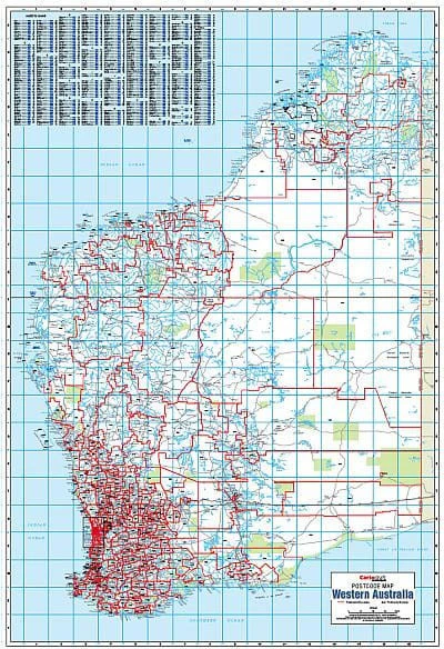
Western Australia Postcode Laminated Wall Map 788 x 1120mm
Western Australia Postcode Laminated Wall Map · 788 × 1120 mm
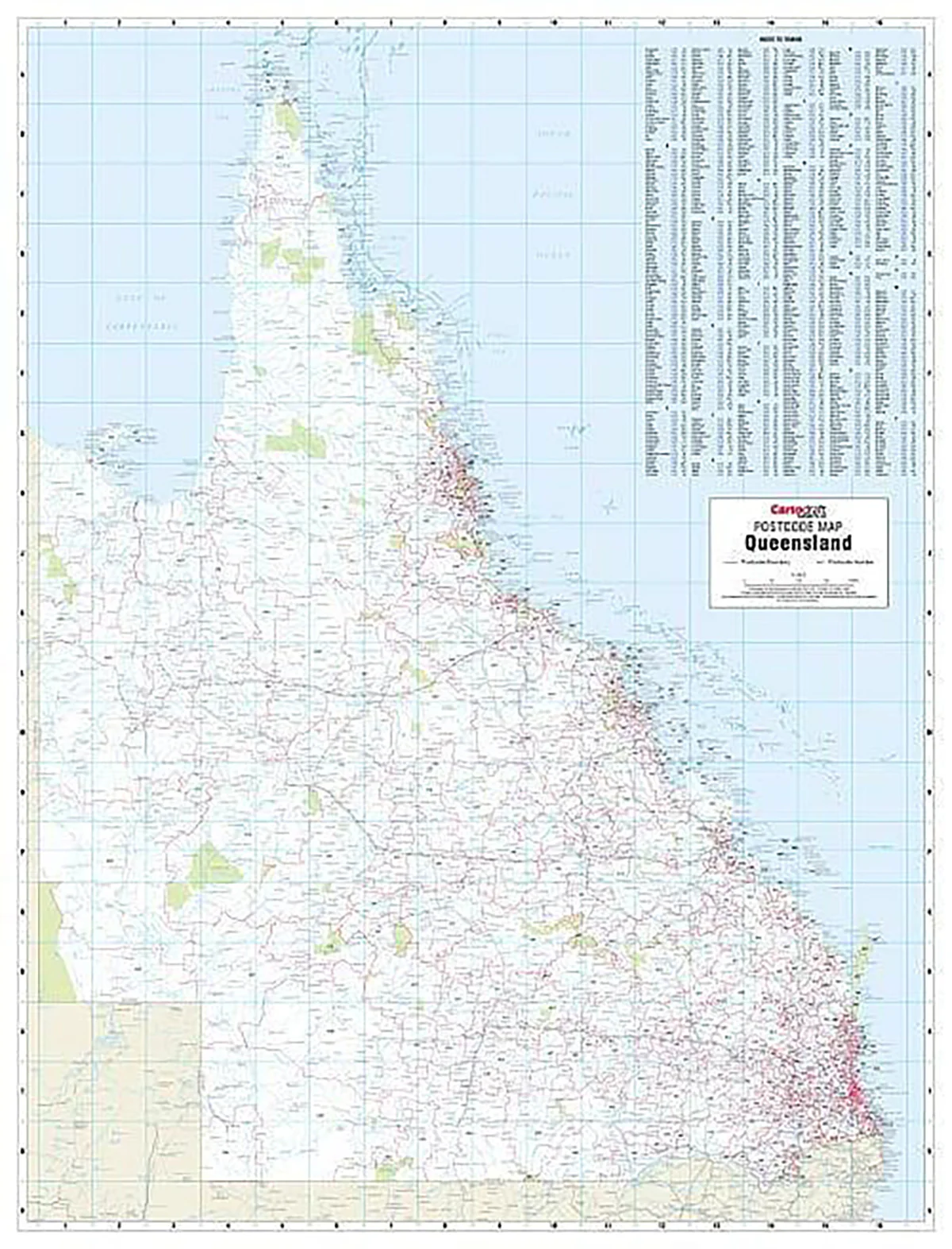
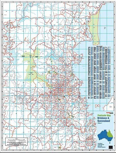
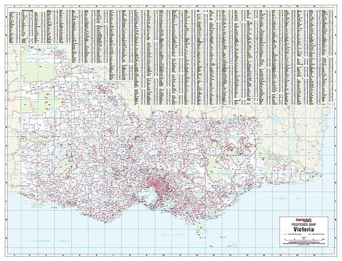
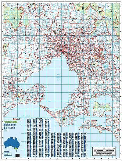
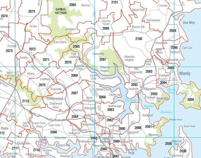
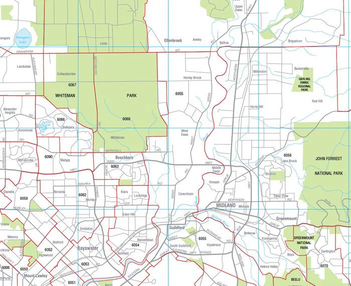
The definitive postcode planning map for WA—covering the entire state in one clear, durable, wall-sized view. Cartodraft’s Western Australia Postcode Map presents postcode boundaries and numbers across metro Perth and the vast regional areas, supported by a comprehensive suburb and town index. Finished in a robust write-on/wipe-off laminate, this map is a practical, professional tool for any organisation operating across Australia’s largest state.
✅ Why this map is indispensable
-
Complete statewide coverage — the only map that brings every Western Australia postcode and boundary together on one sheet
-
Comprehensive suburb & town index — instantly locate communities and match them with their postcode
-
True write & wipe surface — update territories, service areas, or routes using whiteboard markers; erase cleanly without smudges
-
Dot mapping ready — use Mark-It-Dots to highlight depots, customer clusters, or project sites without harming the surface
-
Built for business — essential for logistics planning, franchise and sales management, regional service allocation, and government reference
🪵 Premium materials (built to last)
This is not a fragile poster—it’s a professional-grade planning tool designed for years of daily use:
-
Heavy base stock — sturdy, bright paper for sharp detail and vibrant colour reproduction
-
True encapsulation lamination — sealed in 2 × 80-micron gloss film, edge-to-edge, for waterproof and tear-resistant strength
-
Write-on/wipe-off finish — works flawlessly with whiteboard markers for annotations that erase cleanly
-
Edge-sealed protection — prevents peeling, fraying, and moisture ingress
-
Colour-managed printing — high-contrast tones ensure legibility from wall distance, even in large rooms
✨ Optional upgrade: Laminated + Timber Hang Rails — natural lacquered timber rails fitted top & bottom with a hanging cord for a professional, ready-to-hang display.
⏱️ Please allow up to 10 working days for hang-railed maps.
🧾 What’s on the map
-
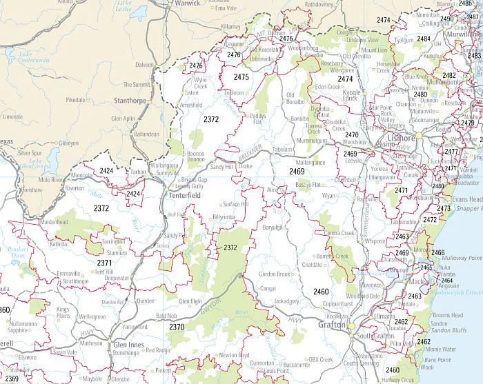
Postcode boundaries & numbers for all of Western Australia—Perth metro, regional centres, mining towns, and remote communities
-
Comprehensive suburb & town index with postcodes for instant cross-reference
-
Major highways, roads, and key regional features (as supplied by Cartodraft)
📐 Size & display
-
788 × 1120 mm (portrait) — large enough to display WA’s vast geography while still compact for office walls
-
Mount directly with 3M picture strips or screws, or upgrade to timber rails for a professional display solution
📦 Practical uses in business & government
-
Sales & franchise territory design — define and manage catchments across one of the world’s largest jurisdictions
-
Logistics & freight planning — map distribution routes from Perth to the Pilbara, Kimberley, and Goldfields
-
Mining & resources operations — allocate postcode regions to projects, camps, and infrastructure
-
Government & administration — reference tool for service delivery, electoral boundaries, and planning
-
Education & training — visual reference for geography, planning courses, and regional studies
-
Professional display — a functional centrepiece for offices, boardrooms, and operations hubs
🧽 Care & maintenance
-
Wipe clean with a soft dry or slightly damp cloth
-
Use only whiteboard markers (avoid permanent or ethanol-based inks)
-
Remove adhesive dots carefully to maintain the laminate edge seal
📊 Specifications
| Field | Detail |
|---|---|
| Title | Western Australia Postcode Laminated Wall Map |
| Publisher | Cartodraft |
| Coverage | Statewide Western Australia — postcode boundaries & numbers |
| Index | Suburb & town index with postcodes |
| Colour-managed, high-contrast cartography | |
| Lamination | 2 × 80-micron gloss film, fully encapsulated, edge-sealed |
| Surface | Write-on/wipe-off (whiteboard-marker compatible) |
| Orientation & Size | Portrait — 788 × 1120 mm |
| Optional Display | Laminated + Timber Hang Rails (natural lacquered; allow up to 10 working days) |
| Best for | Sales, logistics, government, franchise planning, service coverage |
🇦🇺 Our commitment
-
Made & printed in Australia — proudly supporting local production and quality
-
Colour-managed workflow — every map is checked for sharpness, tone, and readability
-
Hand-finished lamination — edges sealed smooth for durability and long service life
-
Packed with care — shipped in protective tubes or flat-packed for safe delivery
-
Family-run expertise — decades of mapping knowledge and customer support
Plan WA with confidence. Select your finish, add accessories, and bring clarity to your wall with the complete statewide postcode view.
Product Information
Product Information
Shipping & Returns
Shipping & Returns

Western Australia Postcode Laminated Wall Map 788 x 1120mm
Western Australia Postcode Laminated Wall Map 788 x 1120mm
Western Australia Postcode Laminated Wall Map · 788 × 1120 mm
The definitive postcode planning map for WA—covering the entire state in one clear, durable, wall-sized view. Cartodraft’s Western Australia Postcode Map presents postcode boundaries and numbers across metro Perth and the vast regional areas, supported by a comprehensive suburb and town index. Finished in a robust write-on/wipe-off laminate, this map is a practical, professional tool for any organisation operating across Australia’s largest state.
✅ Why this map is indispensable
-
Complete statewide coverage — the only map that brings every Western Australia postcode and boundary together on one sheet
-
Comprehensive suburb & town index — instantly locate communities and match them with their postcode
-
True write & wipe surface — update territories, service areas, or routes using whiteboard markers; erase cleanly without smudges
-
Dot mapping ready — use Mark-It-Dots to highlight depots, customer clusters, or project sites without harming the surface
-
Built for business — essential for logistics planning, franchise and sales management, regional service allocation, and government reference
🪵 Premium materials (built to last)
This is not a fragile poster—it’s a professional-grade planning tool designed for years of daily use:
-
Heavy base stock — sturdy, bright paper for sharp detail and vibrant colour reproduction
-
True encapsulation lamination — sealed in 2 × 80-micron gloss film, edge-to-edge, for waterproof and tear-resistant strength
-
Write-on/wipe-off finish — works flawlessly with whiteboard markers for annotations that erase cleanly
-
Edge-sealed protection — prevents peeling, fraying, and moisture ingress
-
Colour-managed printing — high-contrast tones ensure legibility from wall distance, even in large rooms
✨ Optional upgrade: Laminated + Timber Hang Rails — natural lacquered timber rails fitted top & bottom with a hanging cord for a professional, ready-to-hang display.
⏱️ Please allow up to 10 working days for hang-railed maps.
🧾 What’s on the map
-
Postcode boundaries & numbers for all of Western Australia—Perth metro, regional centres, mining towns, and remote communities
-
Comprehensive suburb & town index with postcodes for instant cross-reference
-
Major highways, roads, and key regional features (as supplied by Cartodraft)
📐 Size & display
-
788 × 1120 mm (portrait) — large enough to display WA’s vast geography while still compact for office walls
-
Mount directly with 3M picture strips or screws, or upgrade to timber rails for a professional display solution
📦 Practical uses in business & government
-
Sales & franchise territory design — define and manage catchments across one of the world’s largest jurisdictions
-
Logistics & freight planning — map distribution routes from Perth to the Pilbara, Kimberley, and Goldfields
-
Mining & resources operations — allocate postcode regions to projects, camps, and infrastructure
-
Government & administration — reference tool for service delivery, electoral boundaries, and planning
-
Education & training — visual reference for geography, planning courses, and regional studies
-
Professional display — a functional centrepiece for offices, boardrooms, and operations hubs
🧽 Care & maintenance
-
Wipe clean with a soft dry or slightly damp cloth
-
Use only whiteboard markers (avoid permanent or ethanol-based inks)
-
Remove adhesive dots carefully to maintain the laminate edge seal
📊 Specifications
| Field | Detail |
|---|---|
| Title | Western Australia Postcode Laminated Wall Map |
| Publisher | Cartodraft |
| Coverage | Statewide Western Australia — postcode boundaries & numbers |
| Index | Suburb & town index with postcodes |
| Colour-managed, high-contrast cartography | |
| Lamination | 2 × 80-micron gloss film, fully encapsulated, edge-sealed |
| Surface | Write-on/wipe-off (whiteboard-marker compatible) |
| Orientation & Size | Portrait — 788 × 1120 mm |
| Optional Display | Laminated + Timber Hang Rails (natural lacquered; allow up to 10 working days) |
| Best for | Sales, logistics, government, franchise planning, service coverage |
🇦🇺 Our commitment
-
Made & printed in Australia — proudly supporting local production and quality
-
Colour-managed workflow — every map is checked for sharpness, tone, and readability
-
Hand-finished lamination — edges sealed smooth for durability and long service life
-
Packed with care — shipped in protective tubes or flat-packed for safe delivery
-
Family-run expertise — decades of mapping knowledge and customer support
Plan WA with confidence. Select your finish, add accessories, and bring clarity to your wall with the complete statewide postcode view.
Original: $109.95
-70%$109.95
$32.98Product Information
Product Information
Shipping & Returns
Shipping & Returns
Description
Western Australia Postcode Laminated Wall Map · 788 × 1120 mm
The definitive postcode planning map for WA—covering the entire state in one clear, durable, wall-sized view. Cartodraft’s Western Australia Postcode Map presents postcode boundaries and numbers across metro Perth and the vast regional areas, supported by a comprehensive suburb and town index. Finished in a robust write-on/wipe-off laminate, this map is a practical, professional tool for any organisation operating across Australia’s largest state.
✅ Why this map is indispensable
-
Complete statewide coverage — the only map that brings every Western Australia postcode and boundary together on one sheet
-
Comprehensive suburb & town index — instantly locate communities and match them with their postcode
-
True write & wipe surface — update territories, service areas, or routes using whiteboard markers; erase cleanly without smudges
-
Dot mapping ready — use Mark-It-Dots to highlight depots, customer clusters, or project sites without harming the surface
-
Built for business — essential for logistics planning, franchise and sales management, regional service allocation, and government reference
🪵 Premium materials (built to last)
This is not a fragile poster—it’s a professional-grade planning tool designed for years of daily use:
-
Heavy base stock — sturdy, bright paper for sharp detail and vibrant colour reproduction
-
True encapsulation lamination — sealed in 2 × 80-micron gloss film, edge-to-edge, for waterproof and tear-resistant strength
-
Write-on/wipe-off finish — works flawlessly with whiteboard markers for annotations that erase cleanly
-
Edge-sealed protection — prevents peeling, fraying, and moisture ingress
-
Colour-managed printing — high-contrast tones ensure legibility from wall distance, even in large rooms
✨ Optional upgrade: Laminated + Timber Hang Rails — natural lacquered timber rails fitted top & bottom with a hanging cord for a professional, ready-to-hang display.
⏱️ Please allow up to 10 working days for hang-railed maps.
🧾 What’s on the map
-
Postcode boundaries & numbers for all of Western Australia—Perth metro, regional centres, mining towns, and remote communities
-
Comprehensive suburb & town index with postcodes for instant cross-reference
-
Major highways, roads, and key regional features (as supplied by Cartodraft)
📐 Size & display
-
788 × 1120 mm (portrait) — large enough to display WA’s vast geography while still compact for office walls
-
Mount directly with 3M picture strips or screws, or upgrade to timber rails for a professional display solution
📦 Practical uses in business & government
-
Sales & franchise territory design — define and manage catchments across one of the world’s largest jurisdictions
-
Logistics & freight planning — map distribution routes from Perth to the Pilbara, Kimberley, and Goldfields
-
Mining & resources operations — allocate postcode regions to projects, camps, and infrastructure
-
Government & administration — reference tool for service delivery, electoral boundaries, and planning
-
Education & training — visual reference for geography, planning courses, and regional studies
-
Professional display — a functional centrepiece for offices, boardrooms, and operations hubs
🧽 Care & maintenance
-
Wipe clean with a soft dry or slightly damp cloth
-
Use only whiteboard markers (avoid permanent or ethanol-based inks)
-
Remove adhesive dots carefully to maintain the laminate edge seal
📊 Specifications
| Field | Detail |
|---|---|
| Title | Western Australia Postcode Laminated Wall Map |
| Publisher | Cartodraft |
| Coverage | Statewide Western Australia — postcode boundaries & numbers |
| Index | Suburb & town index with postcodes |
| Colour-managed, high-contrast cartography | |
| Lamination | 2 × 80-micron gloss film, fully encapsulated, edge-sealed |
| Surface | Write-on/wipe-off (whiteboard-marker compatible) |
| Orientation & Size | Portrait — 788 × 1120 mm |
| Optional Display | Laminated + Timber Hang Rails (natural lacquered; allow up to 10 working days) |
| Best for | Sales, logistics, government, franchise planning, service coverage |
🇦🇺 Our commitment
-
Made & printed in Australia — proudly supporting local production and quality
-
Colour-managed workflow — every map is checked for sharpness, tone, and readability
-
Hand-finished lamination — edges sealed smooth for durability and long service life
-
Packed with care — shipped in protective tubes or flat-packed for safe delivery
-
Family-run expertise — decades of mapping knowledge and customer support
Plan WA with confidence. Select your finish, add accessories, and bring clarity to your wall with the complete statewide postcode view.