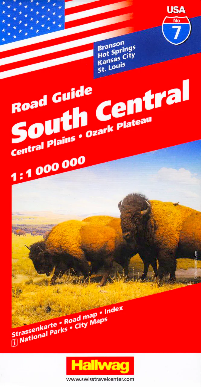
South Central Hallwag USA Map
Scale: 1:1,000,000 | Single-Sided Map with Touring Booklet
Discover the heart of America with the South Central USA Map by Hallwag, a detailed and beautifully designed road map ideal for exploring the Central Plains and the Mississippi Valley. Whether you're planning an ambitious road trip from Dallas to Chicago or simply exploring key regional hubs, this map is a reliable and user-friendly travel companion.
Coverage Highlights
This map offers extensive detail across key states in the South Central region, including Texas, Arkansas, Oklahoma, Louisiana, Missouri, Iowa, and parts of Kansas and Illinois.
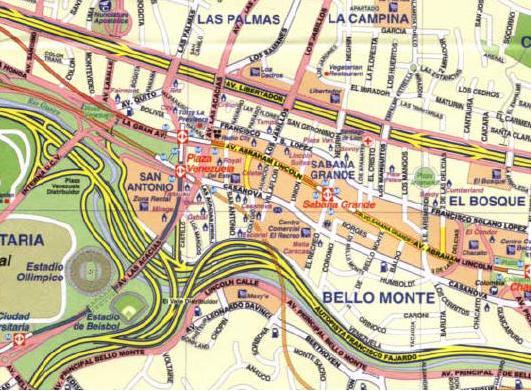
Inset city maps provide detailed street-level views of:
-
Dallas
-
Jackson
-
Shreveport
-
Oklahoma City
-
Memphis
-
Hot Springs
-
Tulsa
-
Little Rock
-
Springfield (MO & IL)
-
St. Louis
-
Topeka
-
Wichita
-
Kansas City
-
Des Moines
-
Omaha
-
Lincoln
These insets are ideal for navigating complex metro areas, locating key attractions, and finding accommodations or transport hubs.
Bonus Touring Booklet Included
In addition to the main map, a complementary travel booklet is included, packed with practical insights and curated travel advice:
| Feature | Description |
|---|---|
| Touring Information | Suggested routes, scenic byways & driving tips |
| Top Attractions | Must-see highlights across the region |
| Insider Tips | Local secrets and off-the-beaten-path ideas |
| Index | Complete place name index for quick reference |
Whether you're heading for the Ozarks, tracing the Blues Highway, or diving into barbecue country, this booklet helps you make the most of your journey.
Map Features at a Glance
-
Scale: 1:1,000,000 – offering the perfect balance of broad coverage and local detail
-
Print Format: Single-sided map for ease of use in the car or on the road
-
Touring Focus: Designed with drivers and explorers in mind
-
High Readability: Clear road classifications, distance markers, and terrain shading
-
Multilingual Legend: Useful for international travellers
Perfect For
-
Long-distance road trips across the South Central USA
-
Route planning and city navigation
-
Travel inspiration and spontaneous detours
-
Gift for RV travellers, adventurers, or map collectors
Published by Hallwag Kümmerly+Frey – renowned Swiss cartographers known for precision, clarity, and durable travel mapping.
Product Information
Product Information
Shipping & Returns
Shipping & Returns


South Central Hallwag USA Map
South Central Hallwag USA Map
Scale: 1:1,000,000 | Single-Sided Map with Touring Booklet
Discover the heart of America with the South Central USA Map by Hallwag, a detailed and beautifully designed road map ideal for exploring the Central Plains and the Mississippi Valley. Whether you're planning an ambitious road trip from Dallas to Chicago or simply exploring key regional hubs, this map is a reliable and user-friendly travel companion.
Coverage Highlights
This map offers extensive detail across key states in the South Central region, including Texas, Arkansas, Oklahoma, Louisiana, Missouri, Iowa, and parts of Kansas and Illinois.
Inset city maps provide detailed street-level views of:
-
Dallas
-
Jackson
-
Shreveport
-
Oklahoma City
-
Memphis
-
Hot Springs
-
Tulsa
-
Little Rock
-
Springfield (MO & IL)
-
St. Louis
-
Topeka
-
Wichita
-
Kansas City
-
Des Moines
-
Omaha
-
Lincoln
These insets are ideal for navigating complex metro areas, locating key attractions, and finding accommodations or transport hubs.
Bonus Touring Booklet Included
In addition to the main map, a complementary travel booklet is included, packed with practical insights and curated travel advice:
| Feature | Description |
|---|---|
| Touring Information | Suggested routes, scenic byways & driving tips |
| Top Attractions | Must-see highlights across the region |
| Insider Tips | Local secrets and off-the-beaten-path ideas |
| Index | Complete place name index for quick reference |
Whether you're heading for the Ozarks, tracing the Blues Highway, or diving into barbecue country, this booklet helps you make the most of your journey.
Map Features at a Glance
-
Scale: 1:1,000,000 – offering the perfect balance of broad coverage and local detail
-
Print Format: Single-sided map for ease of use in the car or on the road
-
Touring Focus: Designed with drivers and explorers in mind
-
High Readability: Clear road classifications, distance markers, and terrain shading
-
Multilingual Legend: Useful for international travellers
Perfect For
-
Long-distance road trips across the South Central USA
-
Route planning and city navigation
-
Travel inspiration and spontaneous detours
-
Gift for RV travellers, adventurers, or map collectors
Published by Hallwag Kümmerly+Frey – renowned Swiss cartographers known for precision, clarity, and durable travel mapping.
Original: $25.95
-70%$25.95
$7.78Product Information
Product Information
Shipping & Returns
Shipping & Returns
Description
Scale: 1:1,000,000 | Single-Sided Map with Touring Booklet
Discover the heart of America with the South Central USA Map by Hallwag, a detailed and beautifully designed road map ideal for exploring the Central Plains and the Mississippi Valley. Whether you're planning an ambitious road trip from Dallas to Chicago or simply exploring key regional hubs, this map is a reliable and user-friendly travel companion.
Coverage Highlights
This map offers extensive detail across key states in the South Central region, including Texas, Arkansas, Oklahoma, Louisiana, Missouri, Iowa, and parts of Kansas and Illinois.
Inset city maps provide detailed street-level views of:
-
Dallas
-
Jackson
-
Shreveport
-
Oklahoma City
-
Memphis
-
Hot Springs
-
Tulsa
-
Little Rock
-
Springfield (MO & IL)
-
St. Louis
-
Topeka
-
Wichita
-
Kansas City
-
Des Moines
-
Omaha
-
Lincoln
These insets are ideal for navigating complex metro areas, locating key attractions, and finding accommodations or transport hubs.
Bonus Touring Booklet Included
In addition to the main map, a complementary travel booklet is included, packed with practical insights and curated travel advice:
| Feature | Description |
|---|---|
| Touring Information | Suggested routes, scenic byways & driving tips |
| Top Attractions | Must-see highlights across the region |
| Insider Tips | Local secrets and off-the-beaten-path ideas |
| Index | Complete place name index for quick reference |
Whether you're heading for the Ozarks, tracing the Blues Highway, or diving into barbecue country, this booklet helps you make the most of your journey.
Map Features at a Glance
-
Scale: 1:1,000,000 – offering the perfect balance of broad coverage and local detail
-
Print Format: Single-sided map for ease of use in the car or on the road
-
Touring Focus: Designed with drivers and explorers in mind
-
High Readability: Clear road classifications, distance markers, and terrain shading
-
Multilingual Legend: Useful for international travellers
Perfect For
-
Long-distance road trips across the South Central USA
-
Route planning and city navigation
-
Travel inspiration and spontaneous detours
-
Gift for RV travellers, adventurers, or map collectors
Published by Hallwag Kümmerly+Frey – renowned Swiss cartographers known for precision, clarity, and durable travel mapping.