Southern & Eastern Africa - Traks4Africa Map
Southern & Eastern Africa — Tracks4Africa Overlander Map
Scale 1 : 2,500,000 | Waterproof Polyart | Regional Adventure Planning
🌍 Cape to Serengeti • Desert to Savannah • Borders to Backtracks
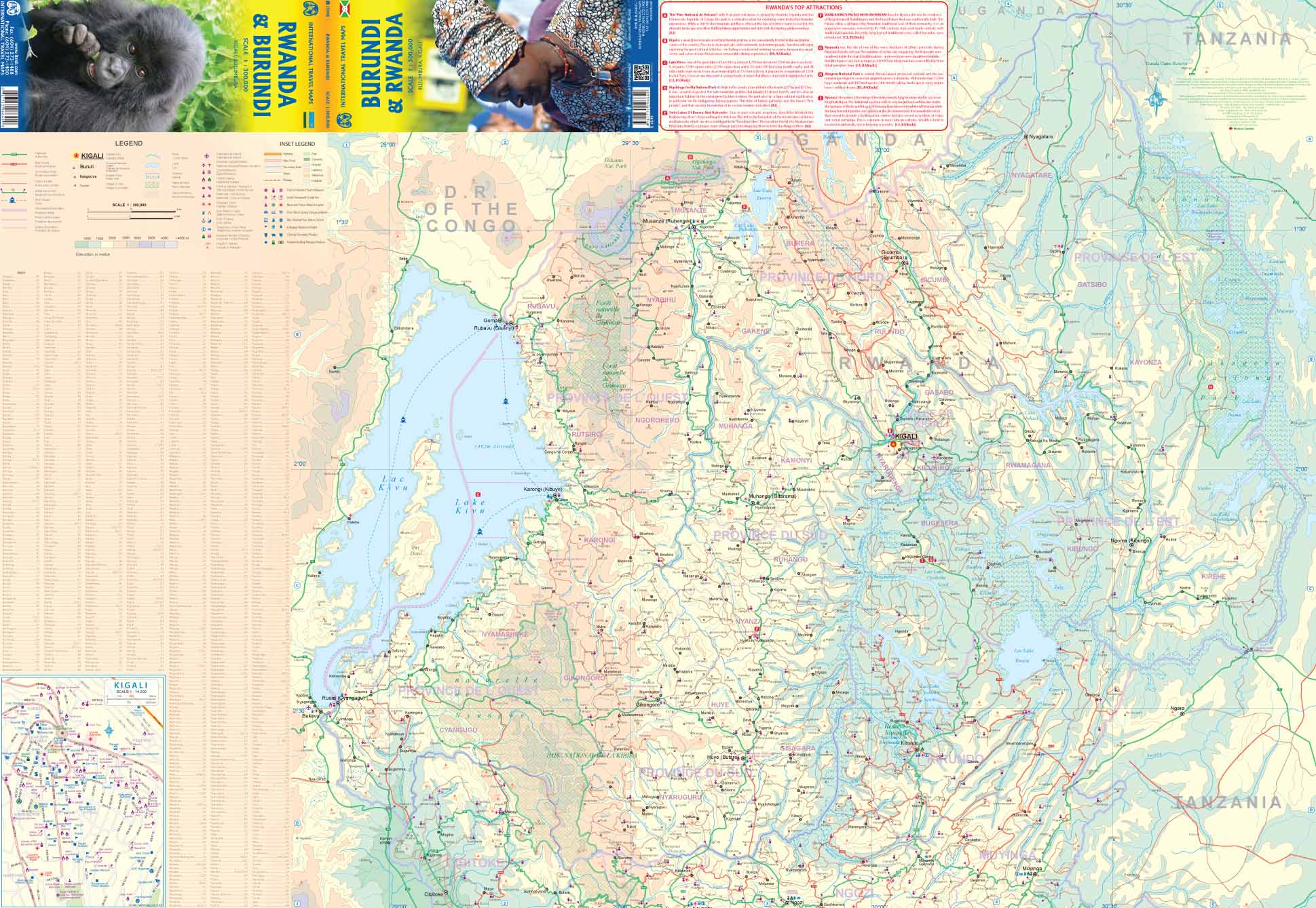
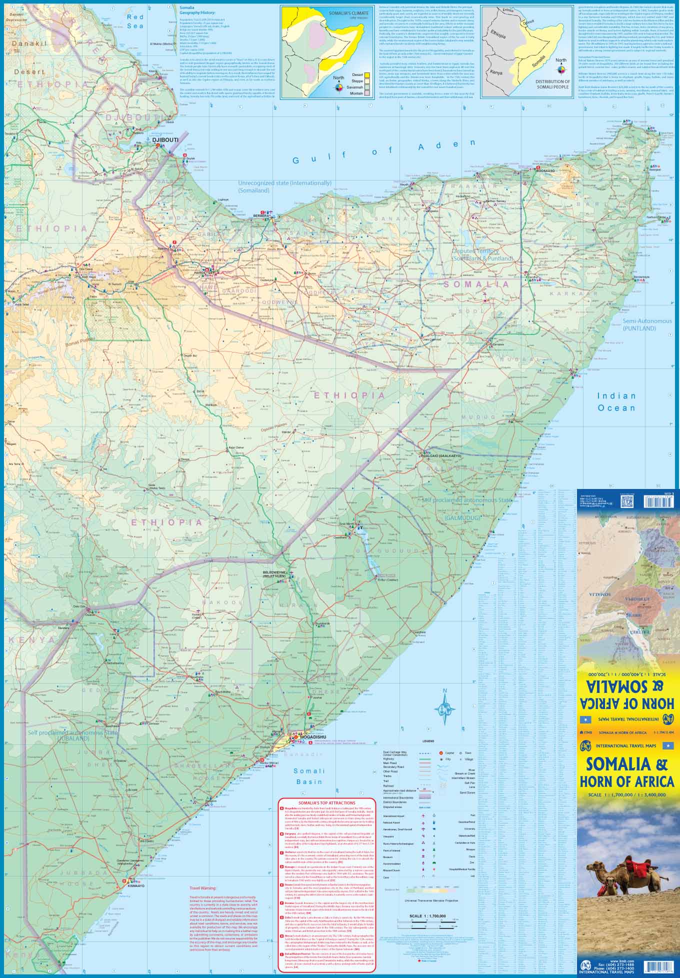
Designed specifically for self-drive travellers, this Southern & Eastern Africa sheet map is built on one powerful idea: every road shown has been driven and verified by the Tracks4Africa community. It’s not a generic atlas — it’s a regional planning map shaped by overlanders, 4×4 explorers and long-distance adventurers who have travelled the routes themselves.
At a broad, practical 1:2,500,000 scale (1 cm ≈ 25 km), this is the map you unfold when planning big journeys across borders, deserts, national parks and remote corridors.
🌟 Why Overlanders Trust This Map
🚙 Community-verified routes — highways, gravel roads and remote tracks driven and logged by real travellers
🧭 Cross-border clarity — international routes and border crossings clearly shown
🏕️ Touring-relevant detail — key parks, towns and major travel corridors highlighted
🗺️ Big-picture planning tool — ideal for mapping multi-country expeditions
💧 Waterproof & tear-resistant Polyart — built for dusty dashboards and camp tables
This is a regional strategy map — perfect for seeing how the pieces fit together before heading into more detailed country-level mapping.
🗺️ Coverage & Regional Scope
This map spans much of Southern and Eastern Africa, making it ideal for extended overland routes such as:
🌅 South Africa to Namibia & Botswana — Kalahari, Etosha, Okavango routes
🏜️ Namibia to Zambia & Zimbabwe — desert tracks and river crossings
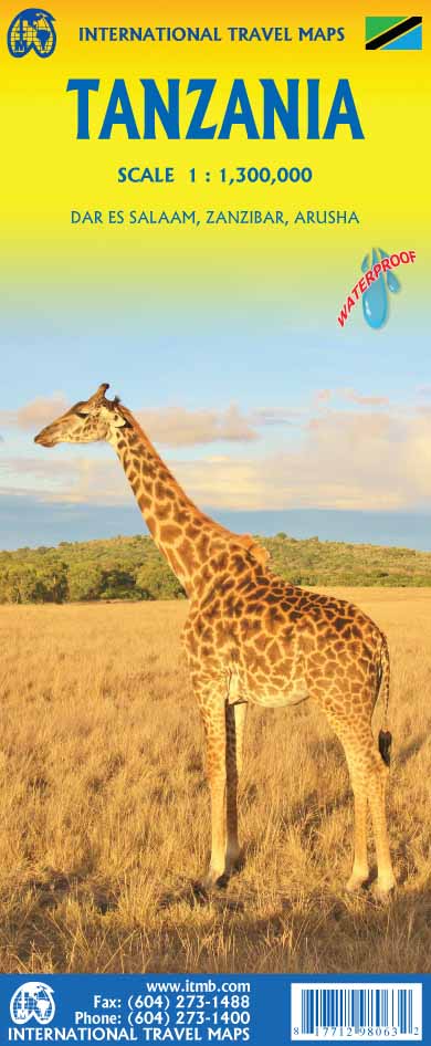
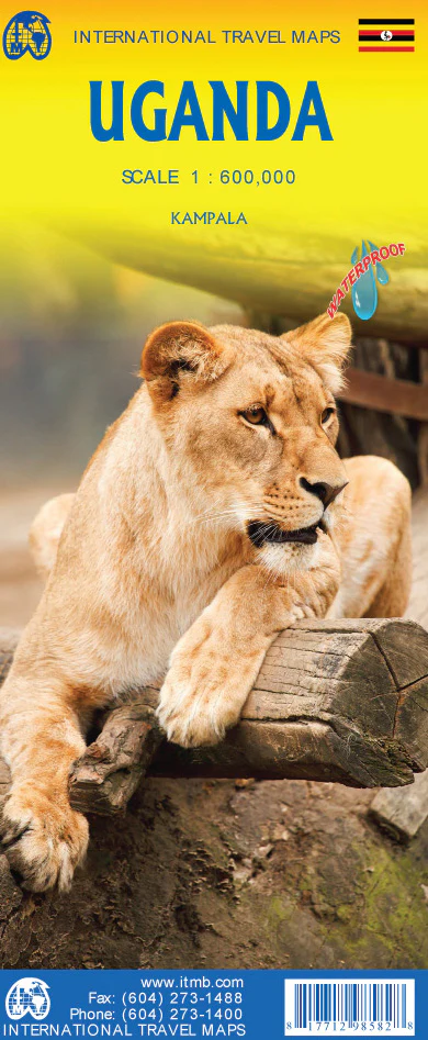
🌍 Botswana to Tanzania & Kenya — wildlife corridors and safari circuits
🌄 Zimbabwe & Mozambique corridors — linking inland routes to the coast
It’s the kind of map you use when planning:
-
A Cape Town to Nairobi expedition
-
A multi-country 4×4 loop
-
A long-term van or camper journey
-
A safari route linking multiple parks
📏 Scale & Use
Scale: 1 : 2,500,000
• 1 cm on the map = 25 km on the ground
• Excellent for regional orientation and long-distance planning
This scale allows you to:
✔️ Visualise distances between major hubs
✔️ Compare route options across borders
✔️ Identify alternate paths in remote areas
✔️ Plan fuel stops and travel stages logically
It complements (rather than replaces) detailed country maps or GPS navigation.
💪 Built for the Field — Polyart Print
Unlike standard paper maps, this edition is printed on waterproof and tear-resistant Polyart:
💧 Rain-resistant
🌞 Heat-tolerant
🏕️ Camp-table durable
🚙 Glovebox friendly
No need to panic if it gets dusty, damp or folded repeatedly — it’s designed for real-world expedition use.
🎯 Who This Map Is For
🚙 4×4 overlanders
🏕️ Campervan & rooftop tent travellers
🌍 Long-haul adventurers crossing borders
📍 Safari planners and independent explorers
🧭 Dreamers planning their first African overland journey
If you’re the kind of traveller who spreads a map across the bonnet and traces a finger along gravel lines into the horizon — this map is for you.
📐 Format & Size
📄 Sheet map — folded
📦 Compact when folded for travel
📏 Large-format regional sheet when opened
(Exact dimensions may vary slightly by print batch.)
📦 Important Ordering Note
This is an Order-on-Demand map.
🕒 Please allow up to 10 working days for delivery.
⭐ Why Paper Still Matters in Africa
In remote regions, reception drops. Batteries fail. Screens glare in sun.
A paper map gives you:
✔️ Full regional context at a glance
✔️ Reliable navigation without signal
✔️ Shared planning around a campfire
✔️ A permanent overview that digital zoom can’t replicate
The Tracks4Africa Southern & Eastern Africa Overlander Map is not just a tool — it’s part of the adventure itself.
Product Information
Product Information
Shipping & Returns
Shipping & Returns

Southern & Eastern Africa - Traks4Africa Map
Southern & Eastern Africa - Traks4Africa Map
Southern & Eastern Africa — Tracks4Africa Overlander Map
Scale 1 : 2,500,000 | Waterproof Polyart | Regional Adventure Planning
🌍 Cape to Serengeti • Desert to Savannah • Borders to Backtracks
Designed specifically for self-drive travellers, this Southern & Eastern Africa sheet map is built on one powerful idea: every road shown has been driven and verified by the Tracks4Africa community. It’s not a generic atlas — it’s a regional planning map shaped by overlanders, 4×4 explorers and long-distance adventurers who have travelled the routes themselves.
At a broad, practical 1:2,500,000 scale (1 cm ≈ 25 km), this is the map you unfold when planning big journeys across borders, deserts, national parks and remote corridors.
🌟 Why Overlanders Trust This Map
🚙 Community-verified routes — highways, gravel roads and remote tracks driven and logged by real travellers
🧭 Cross-border clarity — international routes and border crossings clearly shown
🏕️ Touring-relevant detail — key parks, towns and major travel corridors highlighted
🗺️ Big-picture planning tool — ideal for mapping multi-country expeditions
💧 Waterproof & tear-resistant Polyart — built for dusty dashboards and camp tables
This is a regional strategy map — perfect for seeing how the pieces fit together before heading into more detailed country-level mapping.
🗺️ Coverage & Regional Scope
This map spans much of Southern and Eastern Africa, making it ideal for extended overland routes such as:
🌅 South Africa to Namibia & Botswana — Kalahari, Etosha, Okavango routes
🏜️ Namibia to Zambia & Zimbabwe — desert tracks and river crossings
🌍 Botswana to Tanzania & Kenya — wildlife corridors and safari circuits
🌄 Zimbabwe & Mozambique corridors — linking inland routes to the coast
It’s the kind of map you use when planning:
-
A Cape Town to Nairobi expedition
-
A multi-country 4×4 loop
-
A long-term van or camper journey
-
A safari route linking multiple parks
📏 Scale & Use
Scale: 1 : 2,500,000
• 1 cm on the map = 25 km on the ground
• Excellent for regional orientation and long-distance planning
This scale allows you to:
✔️ Visualise distances between major hubs
✔️ Compare route options across borders
✔️ Identify alternate paths in remote areas
✔️ Plan fuel stops and travel stages logically
It complements (rather than replaces) detailed country maps or GPS navigation.
💪 Built for the Field — Polyart Print
Unlike standard paper maps, this edition is printed on waterproof and tear-resistant Polyart:
💧 Rain-resistant
🌞 Heat-tolerant
🏕️ Camp-table durable
🚙 Glovebox friendly
No need to panic if it gets dusty, damp or folded repeatedly — it’s designed for real-world expedition use.
🎯 Who This Map Is For
🚙 4×4 overlanders
🏕️ Campervan & rooftop tent travellers
🌍 Long-haul adventurers crossing borders
📍 Safari planners and independent explorers
🧭 Dreamers planning their first African overland journey
If you’re the kind of traveller who spreads a map across the bonnet and traces a finger along gravel lines into the horizon — this map is for you.
📐 Format & Size
📄 Sheet map — folded
📦 Compact when folded for travel
📏 Large-format regional sheet when opened
(Exact dimensions may vary slightly by print batch.)
📦 Important Ordering Note
This is an Order-on-Demand map.
🕒 Please allow up to 10 working days for delivery.
⭐ Why Paper Still Matters in Africa
In remote regions, reception drops. Batteries fail. Screens glare in sun.
A paper map gives you:
✔️ Full regional context at a glance
✔️ Reliable navigation without signal
✔️ Shared planning around a campfire
✔️ A permanent overview that digital zoom can’t replicate
The Tracks4Africa Southern & Eastern Africa Overlander Map is not just a tool — it’s part of the adventure itself.
Original: $49.95
-70%$49.95
$14.98Product Information
Product Information
Shipping & Returns
Shipping & Returns
Description
Southern & Eastern Africa — Tracks4Africa Overlander Map
Scale 1 : 2,500,000 | Waterproof Polyart | Regional Adventure Planning
🌍 Cape to Serengeti • Desert to Savannah • Borders to Backtracks
Designed specifically for self-drive travellers, this Southern & Eastern Africa sheet map is built on one powerful idea: every road shown has been driven and verified by the Tracks4Africa community. It’s not a generic atlas — it’s a regional planning map shaped by overlanders, 4×4 explorers and long-distance adventurers who have travelled the routes themselves.
At a broad, practical 1:2,500,000 scale (1 cm ≈ 25 km), this is the map you unfold when planning big journeys across borders, deserts, national parks and remote corridors.
🌟 Why Overlanders Trust This Map
🚙 Community-verified routes — highways, gravel roads and remote tracks driven and logged by real travellers
🧭 Cross-border clarity — international routes and border crossings clearly shown
🏕️ Touring-relevant detail — key parks, towns and major travel corridors highlighted
🗺️ Big-picture planning tool — ideal for mapping multi-country expeditions
💧 Waterproof & tear-resistant Polyart — built for dusty dashboards and camp tables
This is a regional strategy map — perfect for seeing how the pieces fit together before heading into more detailed country-level mapping.
🗺️ Coverage & Regional Scope
This map spans much of Southern and Eastern Africa, making it ideal for extended overland routes such as:
🌅 South Africa to Namibia & Botswana — Kalahari, Etosha, Okavango routes
🏜️ Namibia to Zambia & Zimbabwe — desert tracks and river crossings
🌍 Botswana to Tanzania & Kenya — wildlife corridors and safari circuits
🌄 Zimbabwe & Mozambique corridors — linking inland routes to the coast
It’s the kind of map you use when planning:
-
A Cape Town to Nairobi expedition
-
A multi-country 4×4 loop
-
A long-term van or camper journey
-
A safari route linking multiple parks
📏 Scale & Use
Scale: 1 : 2,500,000
• 1 cm on the map = 25 km on the ground
• Excellent for regional orientation and long-distance planning
This scale allows you to:
✔️ Visualise distances between major hubs
✔️ Compare route options across borders
✔️ Identify alternate paths in remote areas
✔️ Plan fuel stops and travel stages logically
It complements (rather than replaces) detailed country maps or GPS navigation.
💪 Built for the Field — Polyart Print
Unlike standard paper maps, this edition is printed on waterproof and tear-resistant Polyart:
💧 Rain-resistant
🌞 Heat-tolerant
🏕️ Camp-table durable
🚙 Glovebox friendly
No need to panic if it gets dusty, damp or folded repeatedly — it’s designed for real-world expedition use.
🎯 Who This Map Is For
🚙 4×4 overlanders
🏕️ Campervan & rooftop tent travellers
🌍 Long-haul adventurers crossing borders
📍 Safari planners and independent explorers
🧭 Dreamers planning their first African overland journey
If you’re the kind of traveller who spreads a map across the bonnet and traces a finger along gravel lines into the horizon — this map is for you.
📐 Format & Size
📄 Sheet map — folded
📦 Compact when folded for travel
📏 Large-format regional sheet when opened
(Exact dimensions may vary slightly by print batch.)
📦 Important Ordering Note
This is an Order-on-Demand map.
🕒 Please allow up to 10 working days for delivery.
⭐ Why Paper Still Matters in Africa
In remote regions, reception drops. Batteries fail. Screens glare in sun.
A paper map gives you:
✔️ Full regional context at a glance
✔️ Reliable navigation without signal
✔️ Shared planning around a campfire
✔️ A permanent overview that digital zoom can’t replicate
The Tracks4Africa Southern & Eastern Africa Overlander Map is not just a tool — it’s part of the adventure itself.