Europe Collins Folded Map
Collins Europe Road Map – Folded
Fully Updated | Colour-Coded Countries | Ideal for Route Planning
Scale: 1:5,000,000 (79 miles to 1 inch / 50 km to 1 cm)
Format: Folded Paper Map
Size: Standard travel format
Ships from Australia – Next Business Day Dispatch
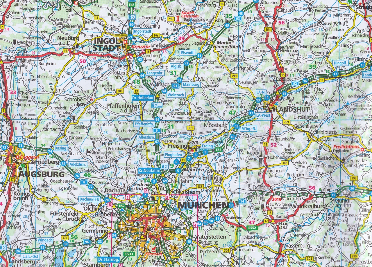
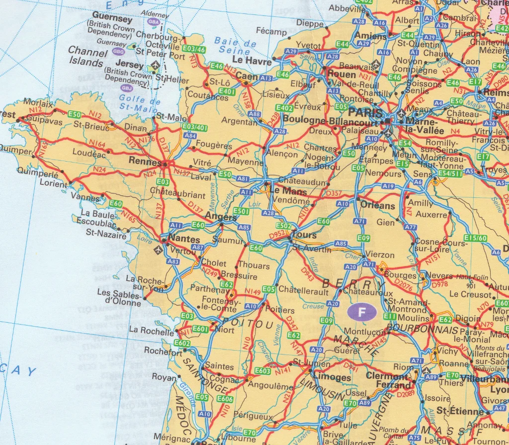
Navigate Europe with confidence using this fully revised and updated road map from Collins. Designed for travelers, road-trippers, and planners, this large-format folded map clearly presents Europe’s road, rail, and urban networks — making it ideal for both trip planning and on-the-go reference.
This easy-to-use map includes a full place name index, country colour-coding for quick reference, and helpful extras such as a distance chart, EU member state overview, and multilingual key. Whether you're planning a grand tour across the continent or simply need a reliable European reference, this map has you covered.
🌍 Area of Coverage
Covers the entirety of Europe, from:
-
🇳🇴 North Cape (Norway) to 🇬🇮 Gibraltar
-
🇮🇪 Ireland to areas east of 🇷🇺 Moscow
-
🧊 Iceland and 🇨🇾 Cyprus are also included
🌟 Key Features
-
🎨 Countries shown in different colours for easy identification
-
🛣️ Clearly marked motorways, A-roads, European Route numbers, and railways
-
✈️ Airports, major cities, towns, and ferry routes labelled
-
🧭 Multilingual legend (English, French, German, Spanish, Italian)
-
📏 Distance chart (in kilometres) between major cities
-
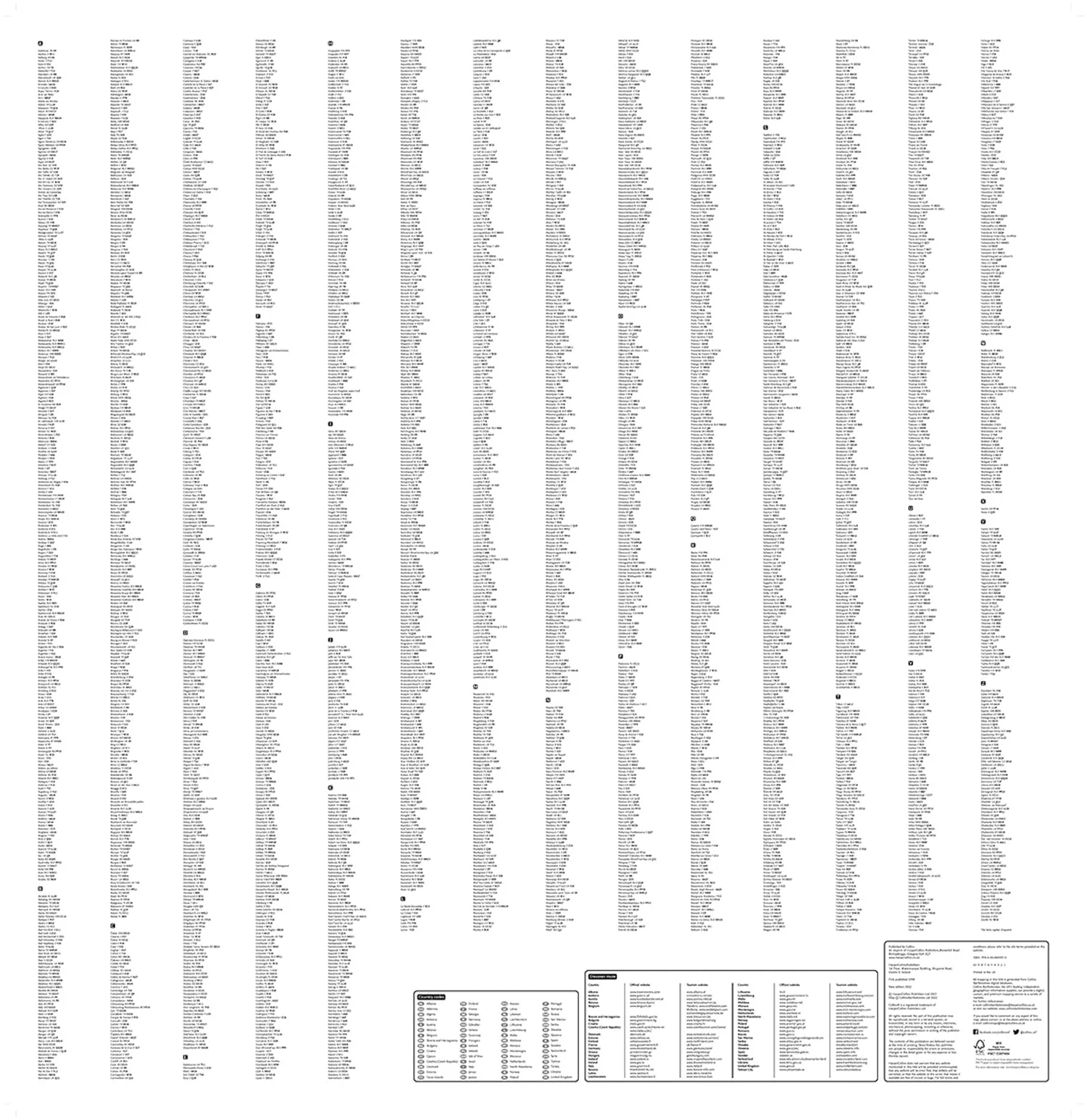
🗃️ Full place name index conveniently printed on the reverse
-
🇪🇺 European Union overview map showing member states and Eurozone countries
-
🔗 Internet links for further travel and planning resources
-
🔤 Country code abbreviations listed (e.g. GB, D, F)
📦 Product Specifications
| Feature | Details |
|---|---|
| Publisher | Collins |
| Edition | Latest revised edition |
| Map Type | Folded paper map |
| Scale | 1:5,000,000 |
| Format | Multilingual (EN, FR, DE, ES, IT) |
| Size | Folded for travel convenience |
| Shipping | From Australia – next business day dispatch |
🧳 Who Is This Map For?
Ideal for:
-
🚗 Road trippers and self-drive travellers across Europe
-
🛤️ Train travellers wanting a quick view of major rail connections
-
✈️ Travel planners and tour companies preparing European itineraries
-
🗺️ Backpackers and overlanders crossing multiple borders
-
🏡 Educators and classrooms needing a clear, multilingual reference map
📌 Why Choose the Collins Europe Map?
This map combines practical travel detail with a clean, colourful design — making it easy to plan routes, estimate distances, and get oriented at a glance. Trusted by travellers across generations, Collins maps are known for their reliability, clarity, and ease of use on the road.
✅ In Stock
📦 Ships Next Business Day from Australia
🌐 Covers 45+ countries at a glance
Looking to complete your collection? Pair with Collins UK & Ireland, France, or Italy road maps for more detailed national coverage.
Product Information
Product Information
Shipping & Returns
Shipping & Returns


Europe Collins Folded Map
Europe Collins Folded Map
Collins Europe Road Map – Folded
Fully Updated | Colour-Coded Countries | Ideal for Route Planning
Scale: 1:5,000,000 (79 miles to 1 inch / 50 km to 1 cm)
Format: Folded Paper Map
Size: Standard travel format
Ships from Australia – Next Business Day Dispatch
Navigate Europe with confidence using this fully revised and updated road map from Collins. Designed for travelers, road-trippers, and planners, this large-format folded map clearly presents Europe’s road, rail, and urban networks — making it ideal for both trip planning and on-the-go reference.
This easy-to-use map includes a full place name index, country colour-coding for quick reference, and helpful extras such as a distance chart, EU member state overview, and multilingual key. Whether you're planning a grand tour across the continent or simply need a reliable European reference, this map has you covered.
🌍 Area of Coverage
Covers the entirety of Europe, from:
-
🇳🇴 North Cape (Norway) to 🇬🇮 Gibraltar
-
🇮🇪 Ireland to areas east of 🇷🇺 Moscow
-
🧊 Iceland and 🇨🇾 Cyprus are also included
🌟 Key Features
-
🎨 Countries shown in different colours for easy identification
-
🛣️ Clearly marked motorways, A-roads, European Route numbers, and railways
-
✈️ Airports, major cities, towns, and ferry routes labelled
-
🧭 Multilingual legend (English, French, German, Spanish, Italian)
-
📏 Distance chart (in kilometres) between major cities
-
🗃️ Full place name index conveniently printed on the reverse
-
🇪🇺 European Union overview map showing member states and Eurozone countries
-
🔗 Internet links for further travel and planning resources
-
🔤 Country code abbreviations listed (e.g. GB, D, F)
📦 Product Specifications
| Feature | Details |
|---|---|
| Publisher | Collins |
| Edition | Latest revised edition |
| Map Type | Folded paper map |
| Scale | 1:5,000,000 |
| Format | Multilingual (EN, FR, DE, ES, IT) |
| Size | Folded for travel convenience |
| Shipping | From Australia – next business day dispatch |
🧳 Who Is This Map For?
Ideal for:
-
🚗 Road trippers and self-drive travellers across Europe
-
🛤️ Train travellers wanting a quick view of major rail connections
-
✈️ Travel planners and tour companies preparing European itineraries
-
🗺️ Backpackers and overlanders crossing multiple borders
-
🏡 Educators and classrooms needing a clear, multilingual reference map
📌 Why Choose the Collins Europe Map?
This map combines practical travel detail with a clean, colourful design — making it easy to plan routes, estimate distances, and get oriented at a glance. Trusted by travellers across generations, Collins maps are known for their reliability, clarity, and ease of use on the road.
✅ In Stock
📦 Ships Next Business Day from Australia
🌐 Covers 45+ countries at a glance
Looking to complete your collection? Pair with Collins UK & Ireland, France, or Italy road maps for more detailed national coverage.
Original: $22.95
-70%$22.95
$6.88Product Information
Product Information
Shipping & Returns
Shipping & Returns
Description
Collins Europe Road Map – Folded
Fully Updated | Colour-Coded Countries | Ideal for Route Planning
Scale: 1:5,000,000 (79 miles to 1 inch / 50 km to 1 cm)
Format: Folded Paper Map
Size: Standard travel format
Ships from Australia – Next Business Day Dispatch
Navigate Europe with confidence using this fully revised and updated road map from Collins. Designed for travelers, road-trippers, and planners, this large-format folded map clearly presents Europe’s road, rail, and urban networks — making it ideal for both trip planning and on-the-go reference.
This easy-to-use map includes a full place name index, country colour-coding for quick reference, and helpful extras such as a distance chart, EU member state overview, and multilingual key. Whether you're planning a grand tour across the continent or simply need a reliable European reference, this map has you covered.
🌍 Area of Coverage
Covers the entirety of Europe, from:
-
🇳🇴 North Cape (Norway) to 🇬🇮 Gibraltar
-
🇮🇪 Ireland to areas east of 🇷🇺 Moscow
-
🧊 Iceland and 🇨🇾 Cyprus are also included
🌟 Key Features
-
🎨 Countries shown in different colours for easy identification
-
🛣️ Clearly marked motorways, A-roads, European Route numbers, and railways
-
✈️ Airports, major cities, towns, and ferry routes labelled
-
🧭 Multilingual legend (English, French, German, Spanish, Italian)
-
📏 Distance chart (in kilometres) between major cities
-
🗃️ Full place name index conveniently printed on the reverse
-
🇪🇺 European Union overview map showing member states and Eurozone countries
-
🔗 Internet links for further travel and planning resources
-
🔤 Country code abbreviations listed (e.g. GB, D, F)
📦 Product Specifications
| Feature | Details |
|---|---|
| Publisher | Collins |
| Edition | Latest revised edition |
| Map Type | Folded paper map |
| Scale | 1:5,000,000 |
| Format | Multilingual (EN, FR, DE, ES, IT) |
| Size | Folded for travel convenience |
| Shipping | From Australia – next business day dispatch |
🧳 Who Is This Map For?
Ideal for:
-
🚗 Road trippers and self-drive travellers across Europe
-
🛤️ Train travellers wanting a quick view of major rail connections
-
✈️ Travel planners and tour companies preparing European itineraries
-
🗺️ Backpackers and overlanders crossing multiple borders
-
🏡 Educators and classrooms needing a clear, multilingual reference map
📌 Why Choose the Collins Europe Map?
This map combines practical travel detail with a clean, colourful design — making it easy to plan routes, estimate distances, and get oriented at a glance. Trusted by travellers across generations, Collins maps are known for their reliability, clarity, and ease of use on the road.
✅ In Stock
📦 Ships Next Business Day from Australia
🌐 Covers 45+ countries at a glance
Looking to complete your collection? Pair with Collins UK & Ireland, France, or Italy road maps for more detailed national coverage.