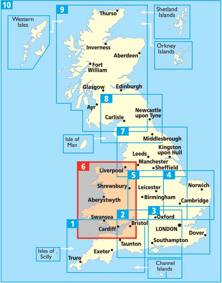
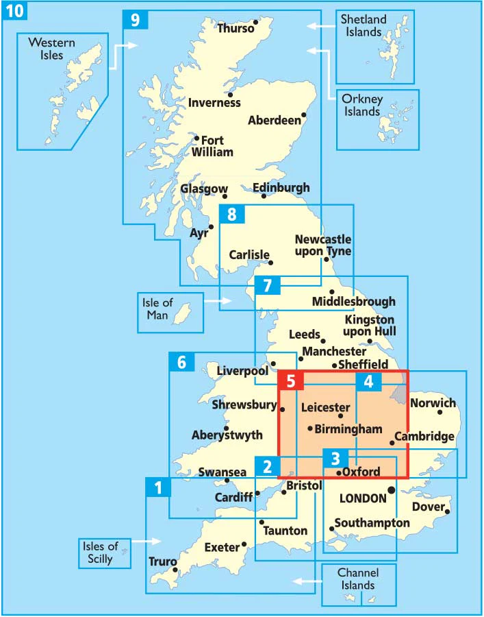
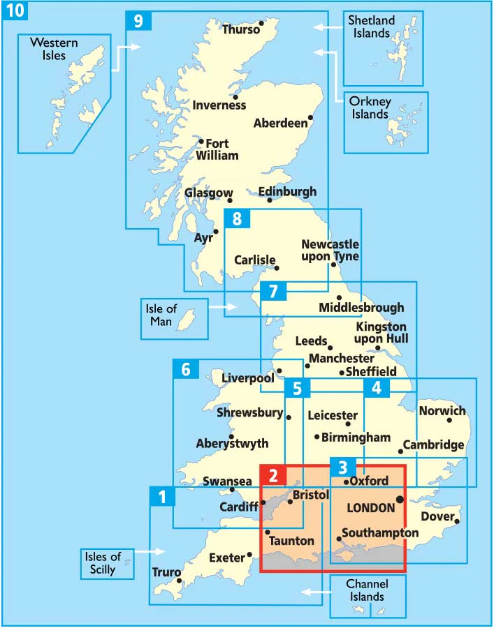
Northern Ireland Pocket Map by Collins
Northern Ireland Pocket Map by Collins
Discover the Heart of the North – Where Heritage, Hospitality & Hidden Gems Await
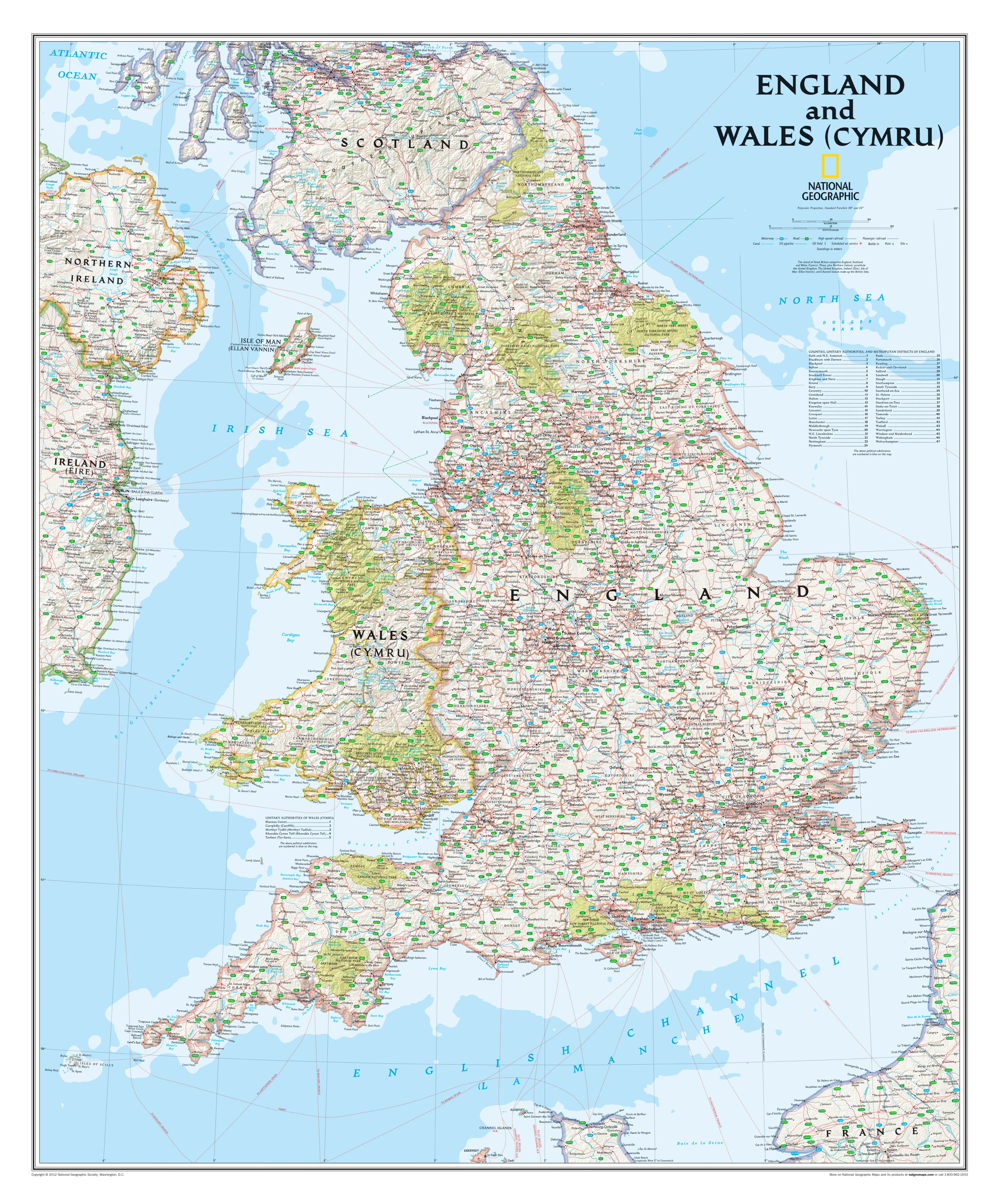
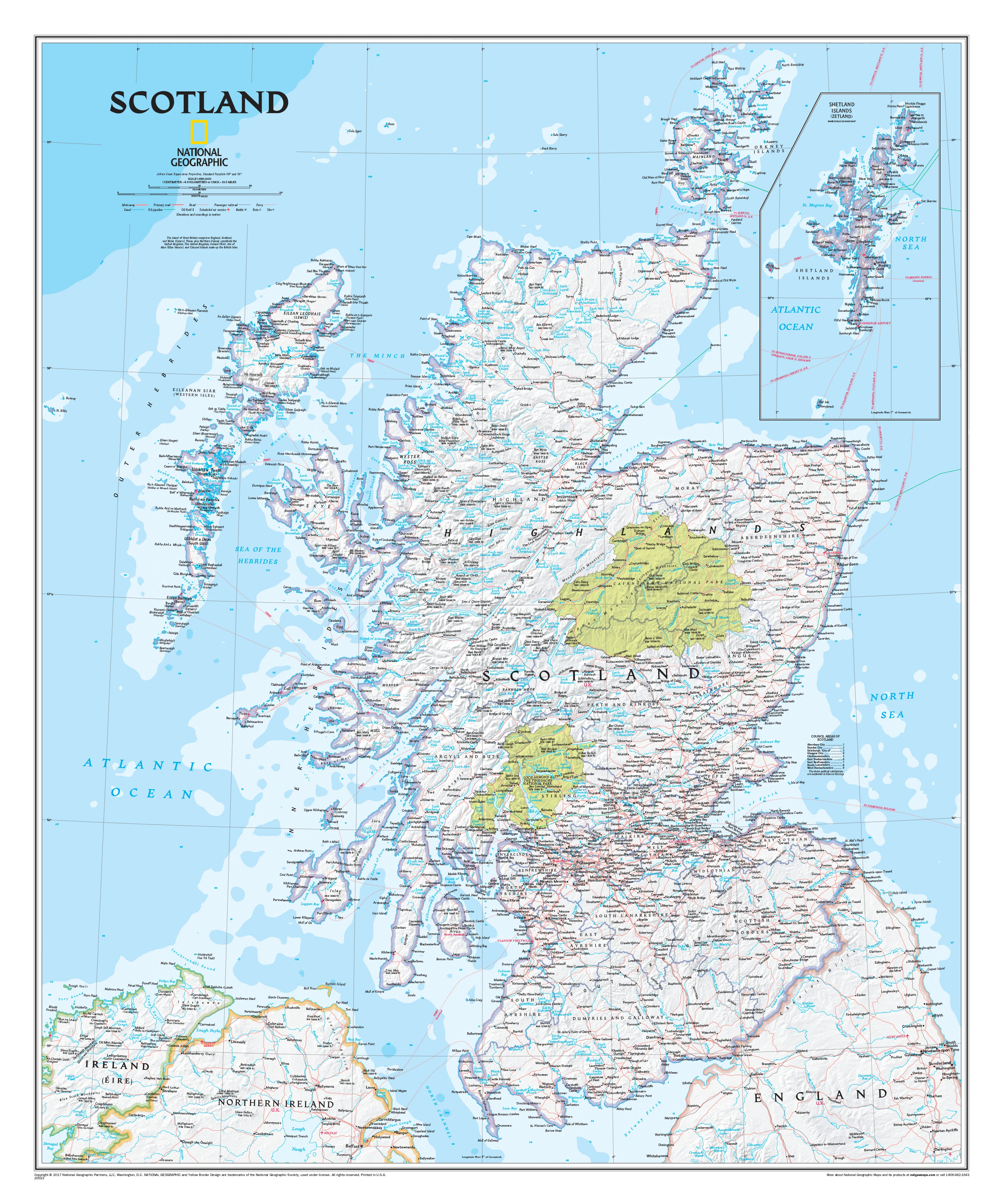
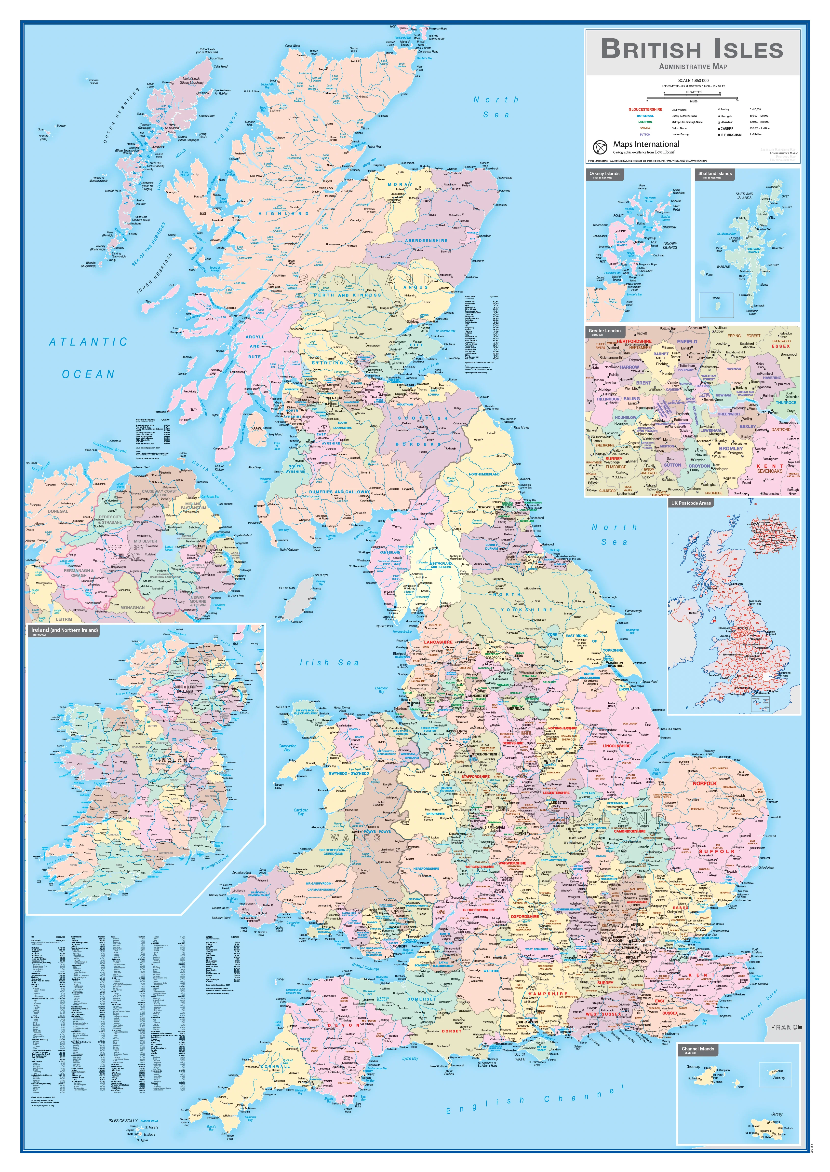
Explore the green hills, ancient castles, and coastal beauty of Northern Ireland with this highly detailed Pocket Map by Collins – your perfect companion for road trips, weekend getaways, or local adventures. Whether you're a first-time visitor tracing the footsteps of the Titanic or a lifelong resident rediscovering your homeland, this beautifully crafted map helps you uncover the charm, culture, and character of every corner.
Designed for clarity and portability, this full-colour map combines Collins’ trusted cartographic precision with rich local information, making it easy to plan your journey or pinpoint that perfect scenic spot, B&B, or pub.
🌄 Why Choose This Map?
From the Glens of Antrim to the wild shores of the Causeway Coast, this pocket-sized map puts everything you need at your fingertips — tourist attractions, places to stay, restaurants, travel services, and more.
🧭 Key Features:
-
✅ Clear, easy-to-read cartography across all of Northern Ireland
-
🗺️ Detailed road network, towns, villages, natural features, and landmarks
-
📍 Highlights major tourist attractions, historic sites, and scenic areas
-
🏨 Includes accommodation, dining, and visitor information centres
-
🧳 Ideal for self-drive travellers, hikers, and culture seekers alike
-
🧵 Folded and compact — slips easily into your glovebox, backpack, or jacket pocket
This is more than a map — it’s a guide to unlocking the stories, heritage, and warmth of Northern Ireland’s people and places.
🖼️ Available in Multiple Premium Formats
Whether you're navigating the open road or decorating your wall with a piece of home, this map comes in formats to suit every purpose:
| Format | Description |
|---|---|
| 📄 Paper | Printed on premium 160 gsm matte paper – ideal for framing under glass or for fold-and-go use. |
| 🛡️ Laminated | Encapsulated in 80-micron gloss laminate – durable, wipe-clean, and ideal for planning trips with whiteboard markers. |
| 🖼️ Laminated with Hang Rails | Supplied with handcrafted wooden hang rails and top cord – ready to display in your home, classroom, or office. |
| 🖼️ Canvas | Printed on heavyweight 395 gsm HP Matte Canvas using pigment-based inks – fade-resistant and elegant. |
| 🖼️ Canvas with Hang Rails | Ready-to-hang canvas version with natural timber rails and hanging cord – a stunning heritage-inspired wall piece. |
⏳ Please allow up to 10 working days for delivery of hang-railed versions, as these are professionally hand-finished to order.
📐 Specifications
| Feature | Details |
|---|---|
| Map Title | Northern Ireland Pocket Map |
| Publisher | Collins |
| Regions Covered | All six counties of Northern Ireland |
| Tourism Info | Attractions, accommodation, restaurants, info centres |
| Map Scale | 1:150,000 |
| Map Size | 720 mm (wide) x 560 mm (high) |
| Orientation | Landscape |
| Language | English |
| Printed in | Australia |
| Edition | Latest available |
🎁 Perfect For:
-
Holidaymakers and road-trippers exploring the North’s Causeway Coast or Mourne Mountains 🚗
-
Locals looking to rediscover nearby trails, castles, and cafés 🌿
-
Visitors diving into Titanic history, Game of Thrones filming locations, or literary heritage 📚
-
Students, educators, and travel agents needing a reliable regional reference 🧭
-
Those with Irish roots tracing family history or gifting a connection to home 🇮🇪
Set your sights on something special.
Let this Northern Ireland Pocket Map by Collins be your trusted guide — from Belfast to Derry, Lough Neagh to the North Channel, every road leads to discovery.
Product Information
Product Information
Shipping & Returns
Shipping & Returns

Northern Ireland Pocket Map by Collins
Northern Ireland Pocket Map by Collins
Northern Ireland Pocket Map by Collins
Discover the Heart of the North – Where Heritage, Hospitality & Hidden Gems Await
Explore the green hills, ancient castles, and coastal beauty of Northern Ireland with this highly detailed Pocket Map by Collins – your perfect companion for road trips, weekend getaways, or local adventures. Whether you're a first-time visitor tracing the footsteps of the Titanic or a lifelong resident rediscovering your homeland, this beautifully crafted map helps you uncover the charm, culture, and character of every corner.
Designed for clarity and portability, this full-colour map combines Collins’ trusted cartographic precision with rich local information, making it easy to plan your journey or pinpoint that perfect scenic spot, B&B, or pub.
🌄 Why Choose This Map?
From the Glens of Antrim to the wild shores of the Causeway Coast, this pocket-sized map puts everything you need at your fingertips — tourist attractions, places to stay, restaurants, travel services, and more.
🧭 Key Features:
-
✅ Clear, easy-to-read cartography across all of Northern Ireland
-
🗺️ Detailed road network, towns, villages, natural features, and landmarks
-
📍 Highlights major tourist attractions, historic sites, and scenic areas
-
🏨 Includes accommodation, dining, and visitor information centres
-
🧳 Ideal for self-drive travellers, hikers, and culture seekers alike
-
🧵 Folded and compact — slips easily into your glovebox, backpack, or jacket pocket
This is more than a map — it’s a guide to unlocking the stories, heritage, and warmth of Northern Ireland’s people and places.
🖼️ Available in Multiple Premium Formats
Whether you're navigating the open road or decorating your wall with a piece of home, this map comes in formats to suit every purpose:
| Format | Description |
|---|---|
| 📄 Paper | Printed on premium 160 gsm matte paper – ideal for framing under glass or for fold-and-go use. |
| 🛡️ Laminated | Encapsulated in 80-micron gloss laminate – durable, wipe-clean, and ideal for planning trips with whiteboard markers. |
| 🖼️ Laminated with Hang Rails | Supplied with handcrafted wooden hang rails and top cord – ready to display in your home, classroom, or office. |
| 🖼️ Canvas | Printed on heavyweight 395 gsm HP Matte Canvas using pigment-based inks – fade-resistant and elegant. |
| 🖼️ Canvas with Hang Rails | Ready-to-hang canvas version with natural timber rails and hanging cord – a stunning heritage-inspired wall piece. |
⏳ Please allow up to 10 working days for delivery of hang-railed versions, as these are professionally hand-finished to order.
📐 Specifications
| Feature | Details |
|---|---|
| Map Title | Northern Ireland Pocket Map |
| Publisher | Collins |
| Regions Covered | All six counties of Northern Ireland |
| Tourism Info | Attractions, accommodation, restaurants, info centres |
| Map Scale | 1:150,000 |
| Map Size | 720 mm (wide) x 560 mm (high) |
| Orientation | Landscape |
| Language | English |
| Printed in | Australia |
| Edition | Latest available |
🎁 Perfect For:
-
Holidaymakers and road-trippers exploring the North’s Causeway Coast or Mourne Mountains 🚗
-
Locals looking to rediscover nearby trails, castles, and cafés 🌿
-
Visitors diving into Titanic history, Game of Thrones filming locations, or literary heritage 📚
-
Students, educators, and travel agents needing a reliable regional reference 🧭
-
Those with Irish roots tracing family history or gifting a connection to home 🇮🇪
Set your sights on something special.
Let this Northern Ireland Pocket Map by Collins be your trusted guide — from Belfast to Derry, Lough Neagh to the North Channel, every road leads to discovery.
Product Information
Product Information
Shipping & Returns
Shipping & Returns
Description
Northern Ireland Pocket Map by Collins
Discover the Heart of the North – Where Heritage, Hospitality & Hidden Gems Await
Explore the green hills, ancient castles, and coastal beauty of Northern Ireland with this highly detailed Pocket Map by Collins – your perfect companion for road trips, weekend getaways, or local adventures. Whether you're a first-time visitor tracing the footsteps of the Titanic or a lifelong resident rediscovering your homeland, this beautifully crafted map helps you uncover the charm, culture, and character of every corner.
Designed for clarity and portability, this full-colour map combines Collins’ trusted cartographic precision with rich local information, making it easy to plan your journey or pinpoint that perfect scenic spot, B&B, or pub.
🌄 Why Choose This Map?
From the Glens of Antrim to the wild shores of the Causeway Coast, this pocket-sized map puts everything you need at your fingertips — tourist attractions, places to stay, restaurants, travel services, and more.
🧭 Key Features:
-
✅ Clear, easy-to-read cartography across all of Northern Ireland
-
🗺️ Detailed road network, towns, villages, natural features, and landmarks
-
📍 Highlights major tourist attractions, historic sites, and scenic areas
-
🏨 Includes accommodation, dining, and visitor information centres
-
🧳 Ideal for self-drive travellers, hikers, and culture seekers alike
-
🧵 Folded and compact — slips easily into your glovebox, backpack, or jacket pocket
This is more than a map — it’s a guide to unlocking the stories, heritage, and warmth of Northern Ireland’s people and places.
🖼️ Available in Multiple Premium Formats
Whether you're navigating the open road or decorating your wall with a piece of home, this map comes in formats to suit every purpose:
| Format | Description |
|---|---|
| 📄 Paper | Printed on premium 160 gsm matte paper – ideal for framing under glass or for fold-and-go use. |
| 🛡️ Laminated | Encapsulated in 80-micron gloss laminate – durable, wipe-clean, and ideal for planning trips with whiteboard markers. |
| 🖼️ Laminated with Hang Rails | Supplied with handcrafted wooden hang rails and top cord – ready to display in your home, classroom, or office. |
| 🖼️ Canvas | Printed on heavyweight 395 gsm HP Matte Canvas using pigment-based inks – fade-resistant and elegant. |
| 🖼️ Canvas with Hang Rails | Ready-to-hang canvas version with natural timber rails and hanging cord – a stunning heritage-inspired wall piece. |
⏳ Please allow up to 10 working days for delivery of hang-railed versions, as these are professionally hand-finished to order.
📐 Specifications
| Feature | Details |
|---|---|
| Map Title | Northern Ireland Pocket Map |
| Publisher | Collins |
| Regions Covered | All six counties of Northern Ireland |
| Tourism Info | Attractions, accommodation, restaurants, info centres |
| Map Scale | 1:150,000 |
| Map Size | 720 mm (wide) x 560 mm (high) |
| Orientation | Landscape |
| Language | English |
| Printed in | Australia |
| Edition | Latest available |
🎁 Perfect For:
-
Holidaymakers and road-trippers exploring the North’s Causeway Coast or Mourne Mountains 🚗
-
Locals looking to rediscover nearby trails, castles, and cafés 🌿
-
Visitors diving into Titanic history, Game of Thrones filming locations, or literary heritage 📚
-
Students, educators, and travel agents needing a reliable regional reference 🧭
-
Those with Irish roots tracing family history or gifting a connection to home 🇮🇪
Set your sights on something special.
Let this Northern Ireland Pocket Map by Collins be your trusted guide — from Belfast to Derry, Lough Neagh to the North Channel, every road leads to discovery.